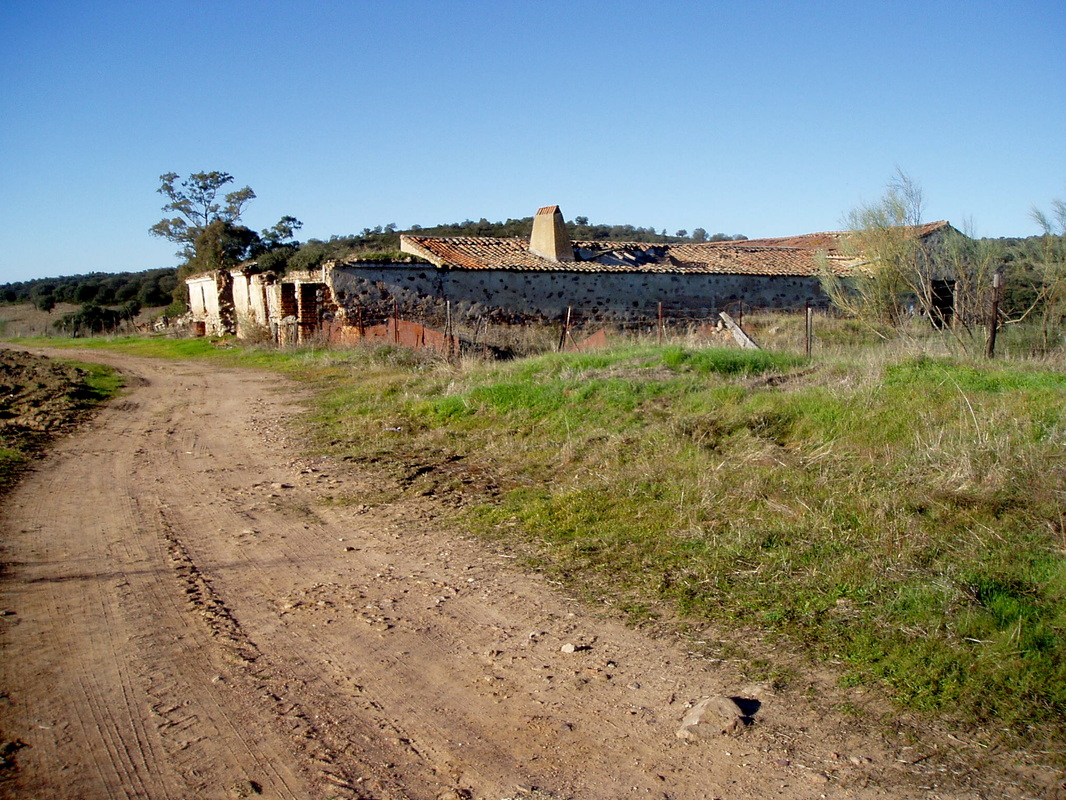
In the past, the posada was a lively staging post and inn which served travellers on the Madrid to Badajoz road
Granite outcrops on the horizon
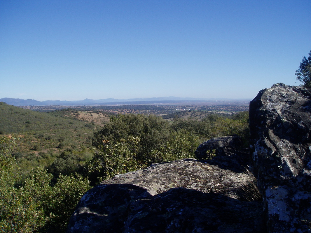
Views out over Badajoz province from the top of the Canchel
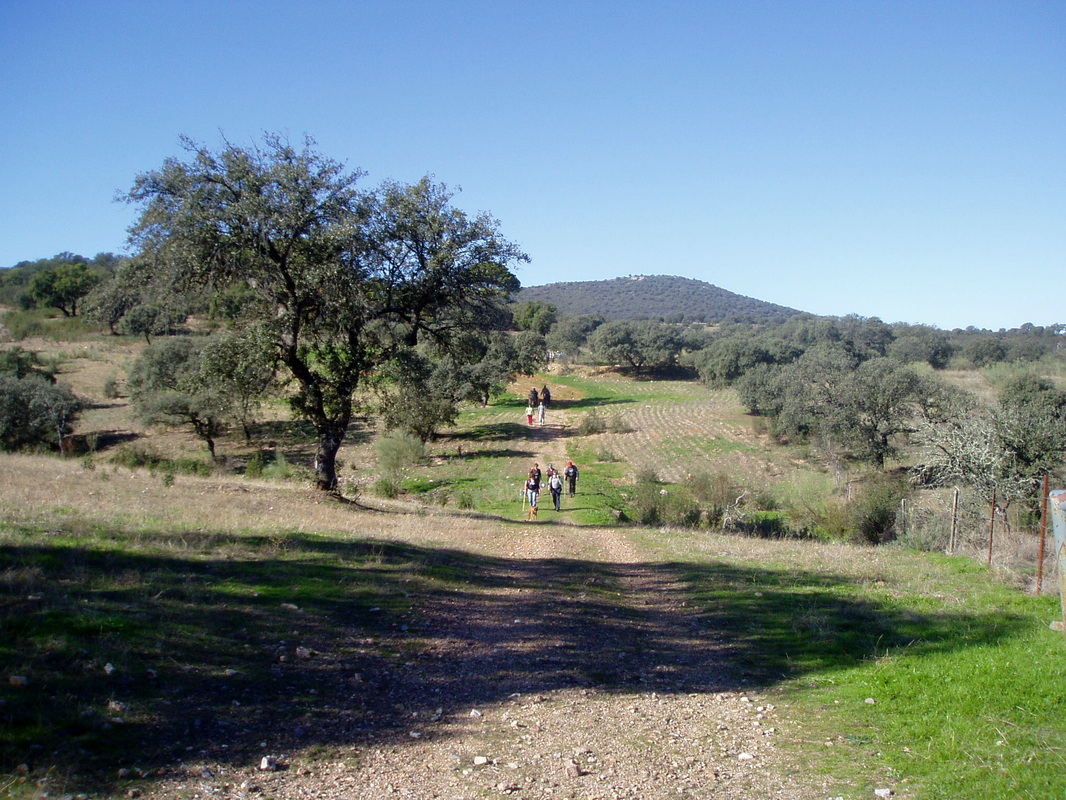
The wide track through fairly open pasture from which eagles are often spotted flying in the skies overhead
|
Canchal de la Serna
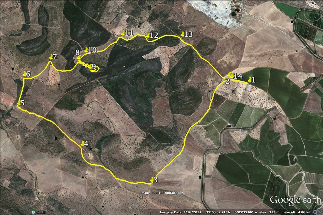
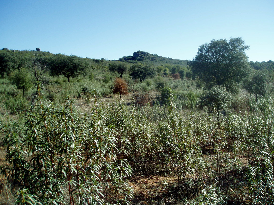
Information This walk does not lie in the Sierra de Montánchez but I have put it here anyway. This route starts along the old Madrid to Badajoz road. In past times travellers on horseback, or in horse drawn carriages, used the road, not only between the two Spanish cities, but also as far as Lisbon. An old, ruined, Posada, a staging post, is on the early part of the route. Our walk passes several granite outcrops, the largest is called the Canchal de la Serna and gives a spectacular view over the area. The route is circular but is almost impossible without some transport to the starting point. Locating the starting point needs a GPS gadget or a good local 1:25,000 map or follow the very precise directions, below. Start: off the Almoharín-Cornalvo Orellana Canal lane (at GPS point number 1, below) Finish: back at the start Time: 3.5 hours Distance: about 12 kilometres Elevation: lowest 279m, highest 428m Difficulty: low Route: circular — map by Google Directions Leave Almoharín at the roundabout on the Cáceres-Miajadas road (EX-206). Cross over the main road from the village in the direction of the Poligono and the Hermitage. Cross the canal, turn right and continue along the canal lane (with the canal on the right) until there is a fork in the lane (20 minutes or so). Take the left fork then turn first right over the canal. This leads on to a dirt track. Stop at a large agricultural building on the left (the only one for miles around). Park and start the walk. 1. N 39º 03’ 45.3” W 06º 04’ 31.0” Walk along the wide dirt track and take the first left on to the ancient Madrid to Badajoz road. The Posada can already be seen ahead. 2. N 39º 03’ 43.4” W 06º 04’ 56.1” The red dirt covered road is wide and flat. The walking is easy. Pass the old staging post. It’s now in ruins but it’s easy to imagine it as a busy bustling place. The courtyard and the outline of the buildings are still intact. After exploring continue to walk, slightly downhill, along the straight road until a junction with a track to the right. Leave the red dirt road for this track. 3. N 39º 02’ 49.7” W 06º 05’ 44.0” The track goes uphill slightly to give a view of distant mountains seen over the nearby mixed trees and bushes. Join a more substantial road and shortly take the left hand fork (marked ‘El Cuadradillo’). Continue on up past an impressive country house on the right. 4. N 39º 03’ 10.0” W 06º 06’ 33.8” Pass wild olives, oaks, a variety of trees and low scrubby bushes. Come to a gate on the right (marked ‘Coto La Parrilla), climb over (it shouldn’t be locked as this is a public footpath) and walk on. 5. N 39º 03’ 32.9” W 06º 07’ 19.4” Come to the other side of this stretch of the walk and pass through the opposite set of gates to meet a small road. Turn right. 6. N 39º 03’ 48.4” W 06º 07’ 15.7” The views are now very nice indeed. We are walking through a greener area with more trees and can see hills all around with granite outcrops on the tops. Come to a junction and make an acute turn to the right to start climbing uphill. 7. N 39º 03’ 58.9” W 06º 06’ 56.3” As the largest granite outcrop, the Canchal de la Serna draws opposite, leave the path and start to make for it. The area abounds in ‘Arbutus Unedo’ trees known as the Strawberry tree and the fruit, when dark red, is sweet and delicious. 8. N39º 03’ 58.3” W 06º 06’ 36.0” This next bit is impossible to describe or to track — simply make for the rocks through the vegetation. It’s not far but the going is extremely confused with a lot of twisting, turning and double-tracking. However a path does exist as this is a route used by walkers. It’s just a bit neglected. Climb up the Canchel itself and stop for a rest to admire the view. 9. N 39º 03’ 55.1” W 06º 06’ 26.7” Walk around behind the rocks for the view out over Badajoz province and then begin going down, to rejoin the path left earlier. 10. N 39º 04’ 03.3” W 06º 06’ 28.0” The path continues through very gentle and typical countryside. It comes to another impressive set of gates on the right. Go through. Walk a short distance to the opposite gates and pass through. 11. N 39º 04’ 12.4” W 06º 06’ 04.8” This leads into an area of pasture. Walk, slightly to the right, while making thee way across this lovely open area. Look out for Imperial Eagles circling above — in my four walks here I’ve never failed to see at least one pair of eagles. 12. N 39º 04’ 11.4” W 06º 05’ 46.8” Continue to walk through this area with grass, shrubs, an unexpected chestnut copse, the eagles overhead and open countryside around. 13. N 39º 04’ 11.3” W 06º 05’ 21.5” The track is easy going and the last part of this route passes very quickly until it rejoins with the starting point on the Madrid to Badajoz road and the car parked beyond. 14. N39º 03' 48.8" W06º 04' 49.2" Photos: October |