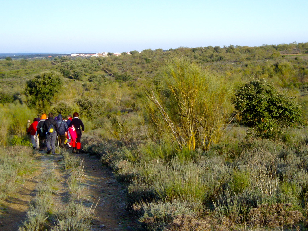
The walk to Botilja
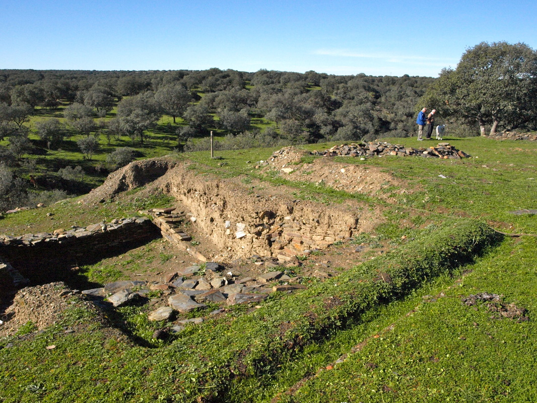
Part of the excavations at Villasviejas
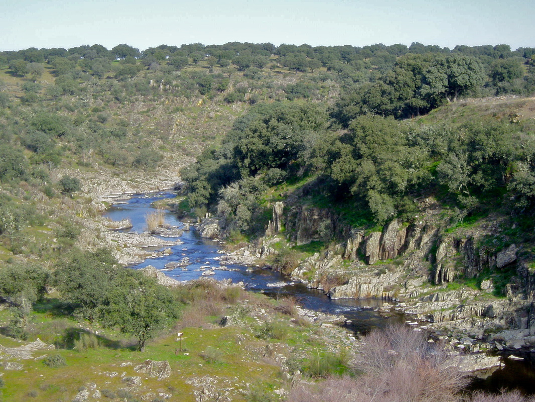
View of the River Tamuja from the excavations
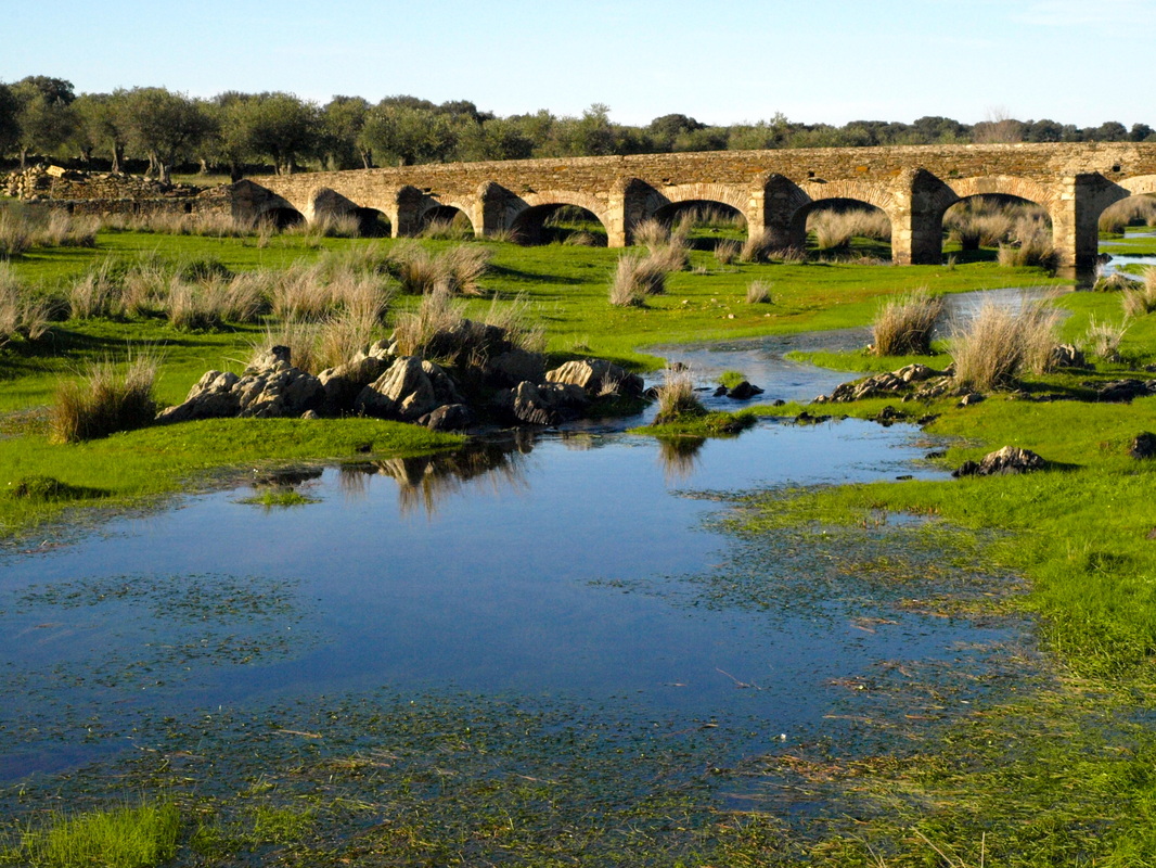
The bridge just outside Botilja that crosses the River Tamuja
|
The Walk of the Celtiberian Village
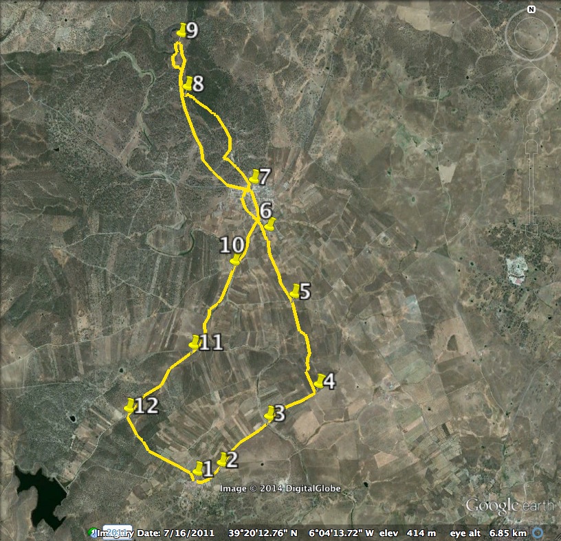
Information This walk includes two bridges, two villages, two ancient stone crosses, a Celtiberian village of the tribe of the Vettones, Villasviejas del Tamuja, typical dehesa and a good stretch of wild countryside. It’s perfect for nature-lovers, but the walk back, along the River Tamuja is especially rewarding. The river is wide and never runs dry so there is always something of interest. However, this walk could be started and finished from Botija and only incorporate the Celtiberian village. It lies 2.60km from the village and makes an easy 5.20km walk with good views of the River Tamuja from the excavated village on the cliff top. Both Benquerencia and Botija are signposted from the EX-206 Cáceres-Miajadas road — on the left coming from Cáceres and on the right coming from Miajadas. The walk can be combined with the following one to make an overall distance of 19.40km. Start: Benquerencia Finish: Benquerencia Time: 4 hours plus stops Distance: 14.50 kilometres Elevation: lowest 382m, highest 454m Difficulty: low Route: circular — map by Google Directions Start in the Plaza de España in the tiny village of Benquerencia. 1. N39º 18’ 36.4” W06º 05’ 03.3” With the church on the left, walk around the church keeping it left to come to a very small, but well-made lane and immediate open countryside. Pass a metal gate, left and follow the lane down with a well-made stone wall on the right. Ahead is an electricity carrier and in the distance, slightly right, is the village of Botija. Pass a seating area with a balustrade overlooking a pond and tennis courts on the left. Come to a T junction. Turn right. Pass an open-air multi-gym on the left. Arrive at a crossroads with an ancient stone cross. 2. N39º 18’ 40.62” W06º 04’ 52.5” Turn left. There are lovely countryside views ahead and a good view of Benquerencia and its church behind. Ignore all junctions. Ahead and left is Botija and way in the distance is the Sierra de Gredos. Pass the Municipal Cemetery on the right and this explains why the lane is well-made. Walk straight ahead on to a dirt track that continues straight ahead. Keep on the track as it goes downhill slightly past various gates into small fincas on the left and open scrubland on the right. Arrive at a wide concrete bridge that crosses the River Tamuja. 3. N39º 19’ 03.2” W06º 04’ 21.4” Cross the bridge and continue straight on up the very clearly defined track which ends at a crossroads. Keep straight on, going slightly uphill, admiring the views around. The vegetation is very pretty in spring with a profusion of flowering bushes. The track opens out to a wider grass track with fencing on either side. Just behind is the Sierra de Montánchez and just ahead, right, is the Sierra de Zarza. Where the fence on the left ends there is a turning, left. 4. N39º 19’ 17.0” W06º 03’ 53.5” Take this path left. Straight ahead is Botija. Keep on the path as far as possible always in the direction of Botija (photo 1). The path goes through a wild area of low-growing bushes and waist-high retama. After about 300m follow the path as it bears right. Negotiate any low stone walls to come to a well-defined grassy track. Go left. Ignore any side paths or junctions and keep ahead in a northerly direction until a crossroads is reached. 5. N39º 19’ 58.8” W06º 04’ 07.4” Cross straight over. Come to a junction on the left but ignore it. About an hour after leaving Benquerencia walk into Botija passing an ancient stone cross on the left but ignoring all junctions. Explore Botija, then leave from the Plaza Mayor by walking north along Calle Extremadura. 6. W39º 20’ 39.39” W06º 04’ 26.75” At the end of Calle Extremadura cross the road, the CCV-93.1 Carretera Local de Torremocha á Botija. Pass a sign on the left for ‘Villasviejas’. Ignore the first turning left and keep straight on past the ‘Torta del Casar’ cheese factory, left. Cross the cattle grid ahead. On the left is a small tarmac lane with an area of dehesa on the right. Ignore this and take the dirt track straight ahead that goes into the dehesa. Follow this track. 7. N39º 20’ 52.22” W06º 04’ 32.59” Pass a substantial agricultural building on the left and follow the track as it winds around to the right. Parts of the dehesa is very pretty with extensive cistus bushes on either side. Reach a crossroads with the small lane from Botija. (It is possible to omit the walk in the dehesa and simply walk on the lane visible in the map, above, but that’s a shame.) 8. N39º 21’ 33.0” W06º 05’ 11.5” Here there is another signpost for ‘Villasviejas’ and the archeological site is 330m ahead and waymarked. Explore at your leisure (photo 2) not forgetting to go down the cliffs to the River Tamuja as well (photo 3). Just follow the yellow arrows around. 9. N39º 21’ 56.3” W06º 05’ 13.7” The above GPS point is the northern extent of the site. Retrace steps to the ‘Villasviejas’ board and return to Botija via the dehesa or the lane. Pass Barrio Villahonda to reach the multiple junction. Walk south ignoring all other junctions. Pass the ancient stone cross, followed by another one within 200m. Come to an arched bridge over the River Tamuja (photo 4). 10. N39º 20’ 14.7” W06º 04’ 41.9” Cross the bridge, turn left and follow the path, keeping the river on the left until it bends away from the path. Reach a crossroads and walk ahead. Keep going — this part of the walk is 2.6km long. 11. N39º 19’ 36.6” W06º 05’ 05.4” At the next crossroads, turn left on to the Camino de Benquerencia. 12. N39º 19’ 06.46” W06º 05’ 44.98” After 1.40km walk ahead into the village. Photos: February, August and December |