|
Lost in Monfragüe
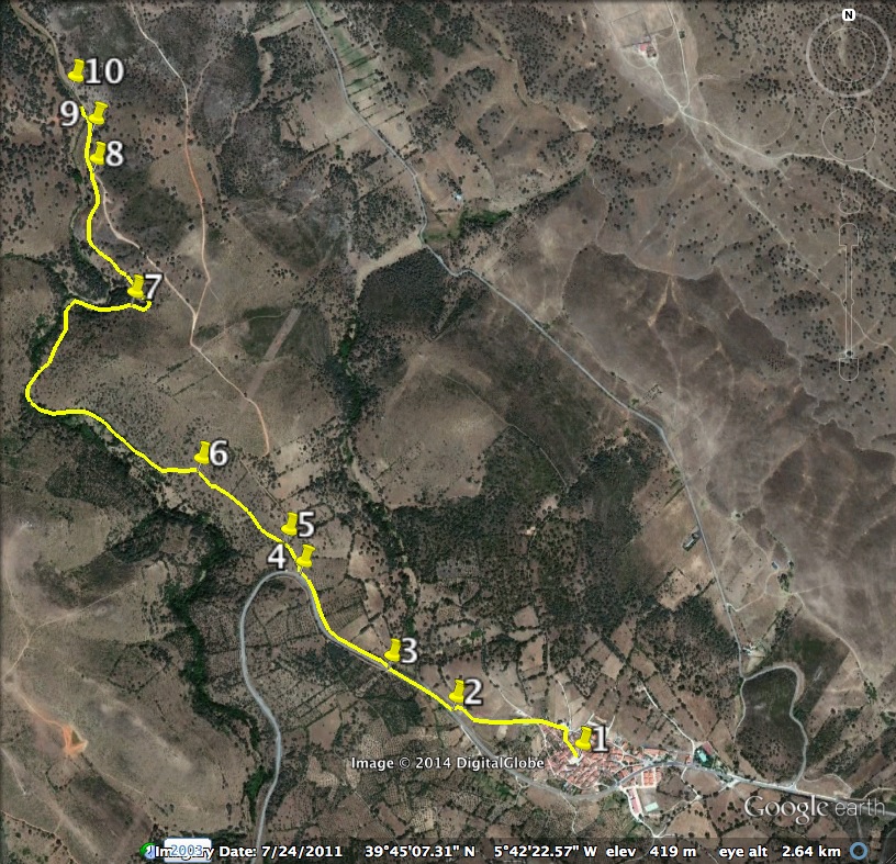
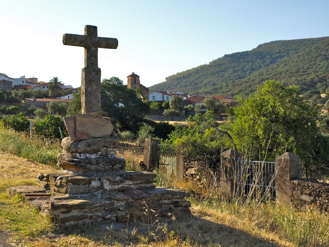
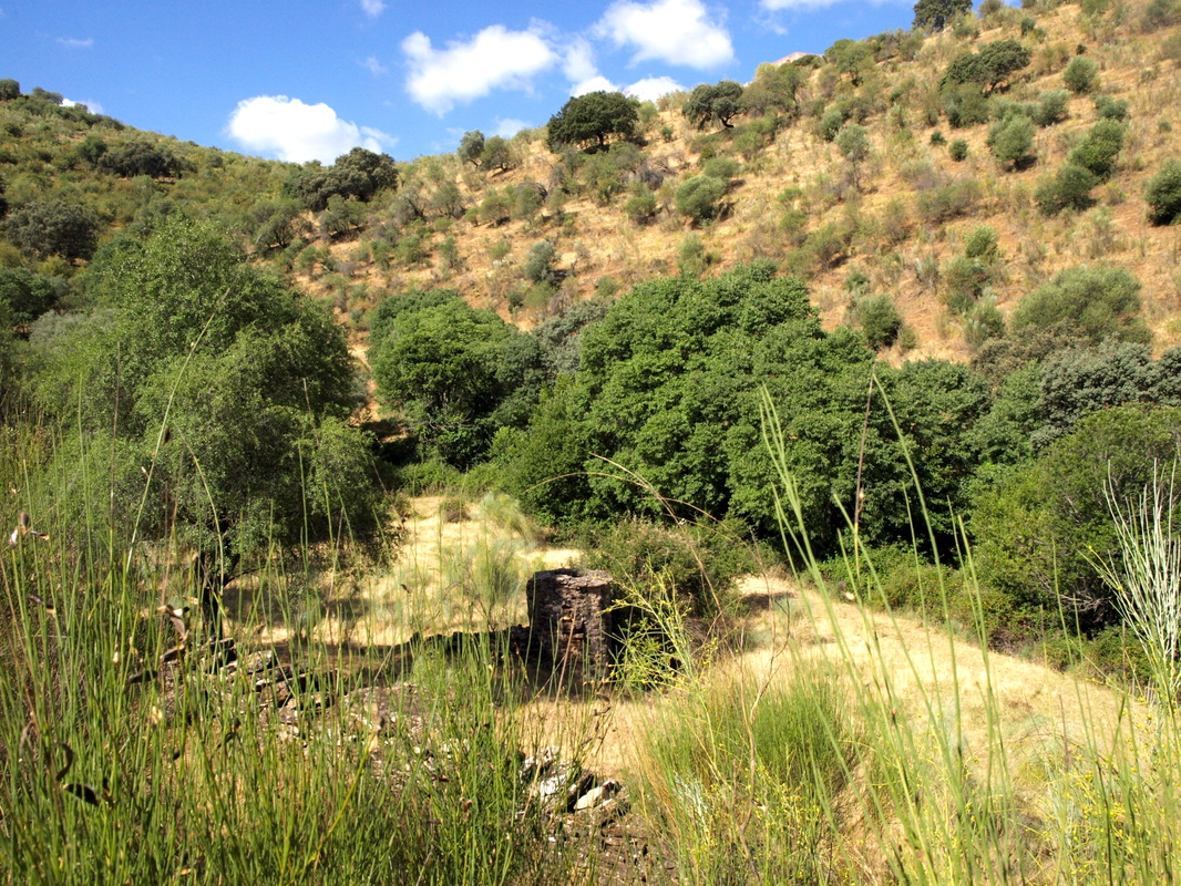
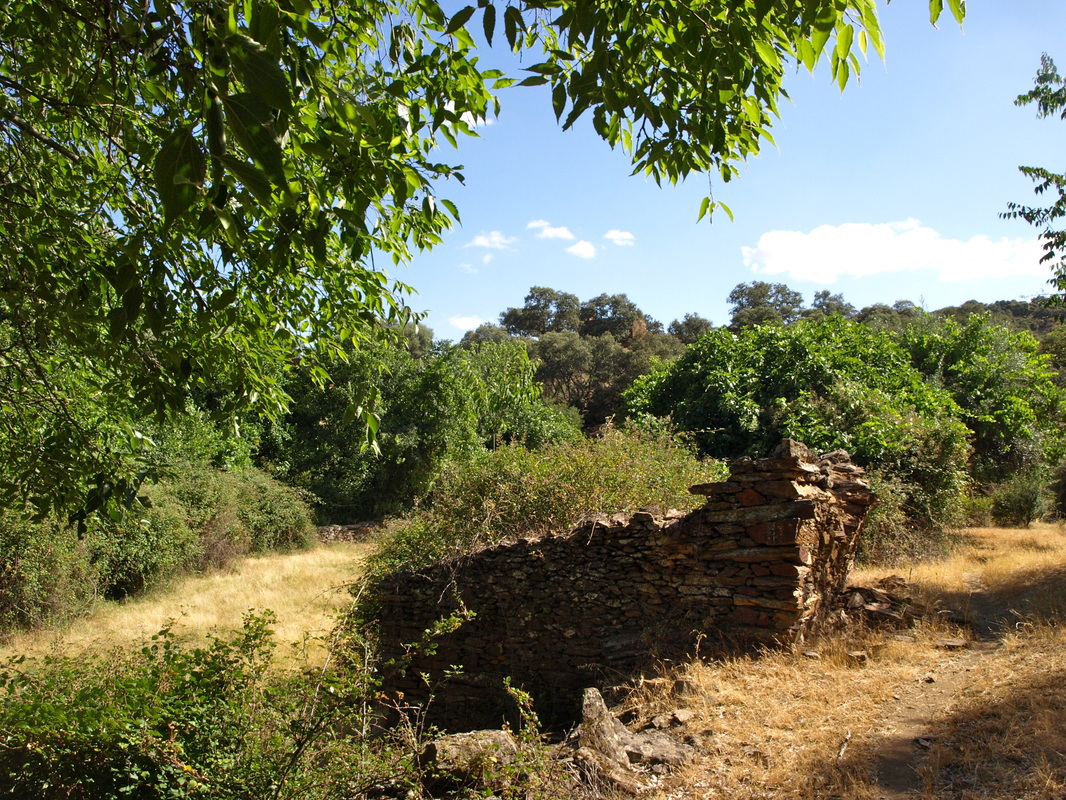
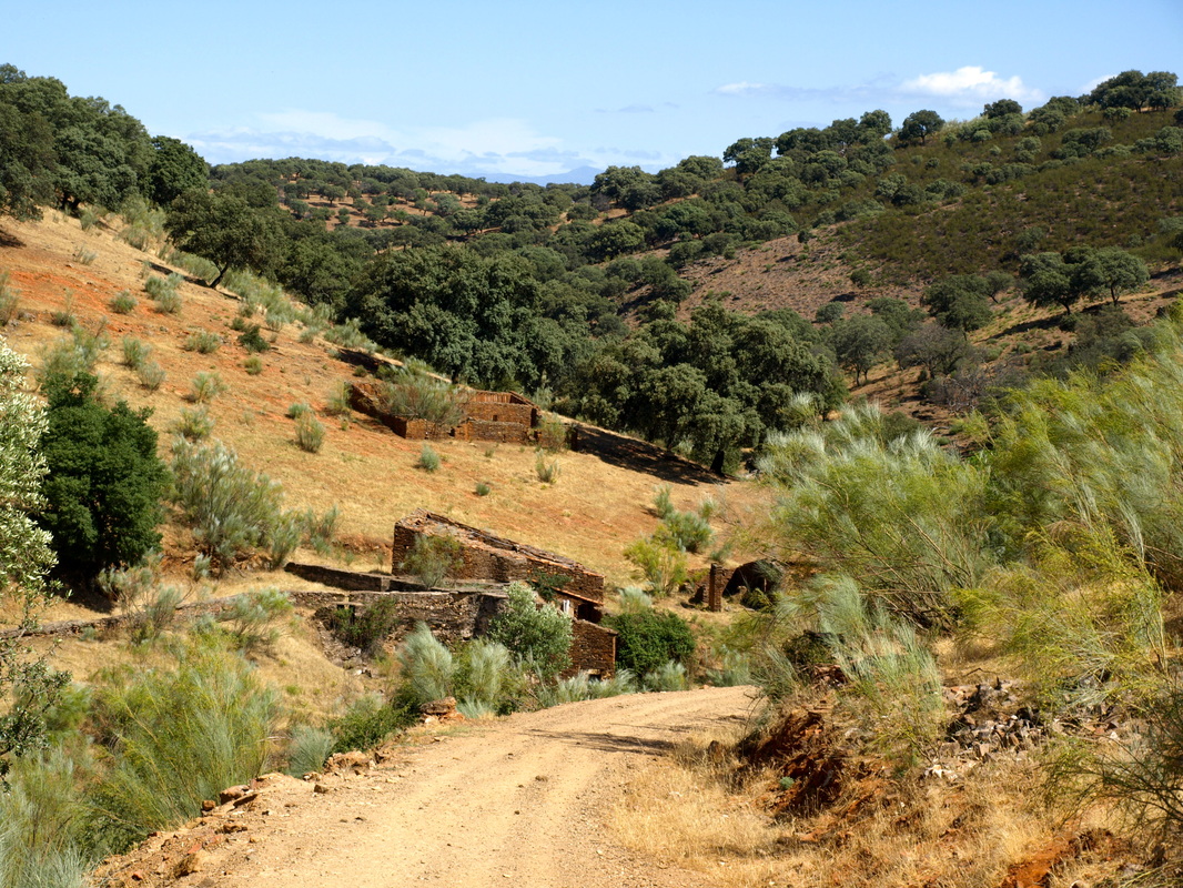
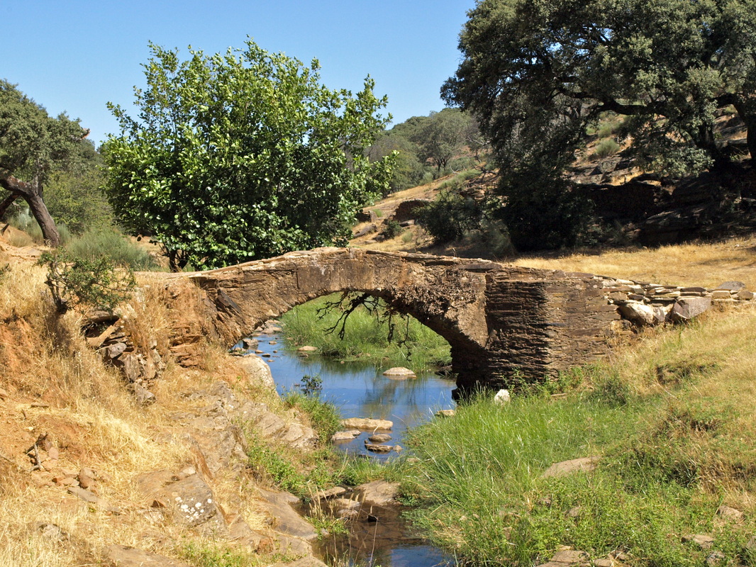
Information A perfect route for walkers who do not really want to go anywhere specific. It passes through delightful Monfragüe countryside following a small river for much of the way. Start: Romangordo Finish: Romangordo Time: 4 hours plus stops Distance: 8 kilometres Elevation: lowest 285m, highest 430m Difficulty: low with medium bits Route: out and back — map by Google Directions Start in the Plaza de España in Romangordo. 1. N39º 44’ 31.55” W05º 42’ 04.11” With the Town Hall on the right and the church over on the left beyond the square, walk ahead. Pass the Casa del Potal on the left and ignore all junctions to reach an open space where there is a multiple junction. Turn left and down. Pass the ‘Route of the English’ Interpretation Centre (open Fridays, Saturdays and Sundays) on the left. Walk down the wide hill, ignore the small turning left. At a Y junction take the left lane. Ahead you can see the Cross of Retamar. Pass the cross and come to a T junction with the main road. 2. N39º 44’ 36.87” W05º 42’ 22.21” Turn right in the direction of Navalmoral de la Mata and Trujillo and walk up the road on the right. Within 50m pass an illustrated waymark and turning, right, for the ‘Route of the English’. Within another 50m come to a signpost for ‘Rutas Makjada Albalat’ and across the road is a parallel signpost for ‘Rutas Bodegas’. Ignore both of these. On the road are painted waymarks: white/pale blue, white/dark blue and white/dark red. Ignore these as well. Turn up the track on the right by the signpost. 3. N39º 44’ 41.53” W05º 42’ 31.23” The track goes up and runs parallel with the road below. Pass a sign on the right, just on the brow of the climb, ‘Reserva de Biosfera Monfragüe’ and a few paces later is a junction waymarked ‘Sender del Bodega’. There are also white/pale blue, white/dark blue waymarks. 4. N39º 44’ 52.02” W05º 42’ 43.77” Turn right to walk down the path. You quickly come to an unlocked gate. Pass through and close it behind you. Walk ahead. After 50m there is a Y junction with a finca entrance in the centre. 5. N39º 44’ 54.72 W05º 42’ 45.26” Follow the path left and down. There is a waymark with an arrow pointing left. (That’s the last waymark I found). The path is quite narrow, dirt with occasional slate making it a bit rough in places. It winds steadily down the side of a valley dotted with lavender, broom, cistus and retama bushes and interspersed with holm oaks, wild olives, stunted thorn trees and rough pasture. There are dry stone walls that seem to come and go on the right. There is evidence of rabbits and a lot of bird song, in season. At times there are several paths to choose from but they are all going in the same direction, downwards and along the side of the valley. After about 300m since the last waymark the dry stone wall on the right ends in a corner and goes upwards. 6. N39º 45’ 02.16” W05º 42’ 57.34” The path drops down more sharply to the left and comes to the valley floor. On the left is a much wider path and a stream bed. How much water is flowing will depend on the time of year and the previous winter’s rainfall but I walked here in July and the stream bed at this point was dry. The valley floor is dotted with fig trees and vines — evidence of cultivation — and there is a slate and granite wall on the left. Walk along the valley floor and come to a break in the wall on the left but continue ahead keeping the wall, left. The path is clear and goes up gently until the valley floor is some 20m below. Pass the tall, round, stone walls of a well in a meadow, below, left. On the left side of the valley the high vegetation-covered side can be seen. The path climbs and then levels off and continues forward following the stream bed below. At a vague Y junction, there is a path, left and down to the stream bed or right and up. I chose the right path. There is another dry stone wall on the left. Keep it left. At another Y junction keep ahead negotiating over-hanging branches from trees. At another Y junction go left and down. Water! There is a pool shaded by alders and there are numerous ruins of slate and granite walls. There are very old olive trees in a flat meadow with neglected vines entwined in the branches. Partridges run around. I think this was once an inhabited place. After exploring the area, either retrace steps to the last Y junction and take the right path or continue ahead from the olive grove. There are paths, right, that climb up to meet the higher (right) path from the previous Y junction at a T junction. Turn left and continue along with the river (now with water) below, left. Keep yet another dry stone wall about 20m on the left as the path goes up gently. Follow the path around the wall as the wall bends left. 7. N39º 45’ 21.20” W05º 43’ 08.00” Pass a distinctive boulder on the right to walk through a gap in a tumbled-down wall. The path comes to a barbed wire fence. Turn left to come 50m from the river and an area of flat slate where the fence has been crushed low. Step over. Several paths go forward. Keep a dry stone wall, right, and the river is left, below. This is an area of oaks and dehesa but with olives. Come to an impressive rocky slate ledge but the climb over is easy because the slate forms steps. The path continues clear through broom. Ahead is an excellent view of the Sierra de Gredos, away to the north. Reach another fence which has been pushed up. Bend down to pass the fence and the path continues ahead. A well-made track joins the path from behind and right. 8. N39º 45’ 35.82” W05º 43’ 13.41” Look back and there is a gate (which would have made passing under the fence redundant but the gate was not visible at that point — use it on the return walk). Walk down the well-made track as it descends quite sharply towards a few buildings with well-made walls of slate but no roofs. By the buildings there is evidence that a mill once stood here as there is a mill race and a well. 9. N39º 45’ 41.72” W05º 43’ 13.96” Depending on the water level use the ford or the small foot-bridge to cross the river and explore the area, have a picnic and enjoy the quiet. The bridge must be medieval as there are worn heraldic shields visible on the side of the bridge. 10. N39º 45’ 43.02” W05º 43’ 15.05” After exploring the bridge area retrace steps back to Romangordo OR go back to the village via the well-made track. Photos: July |
