
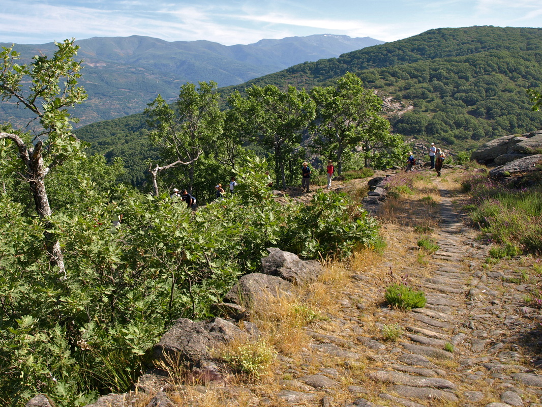
The granite-paved path zig-zags down through low-growing trees and bushes
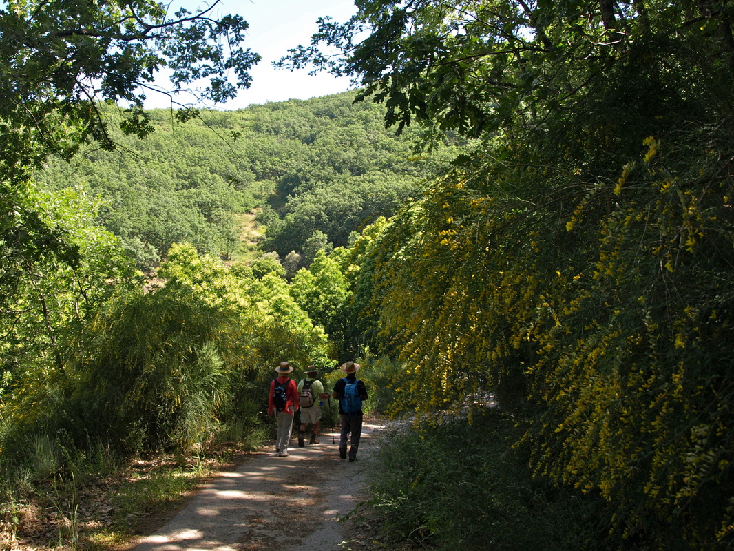
The small lane is lined with shady deciduous trees and flowering bushes
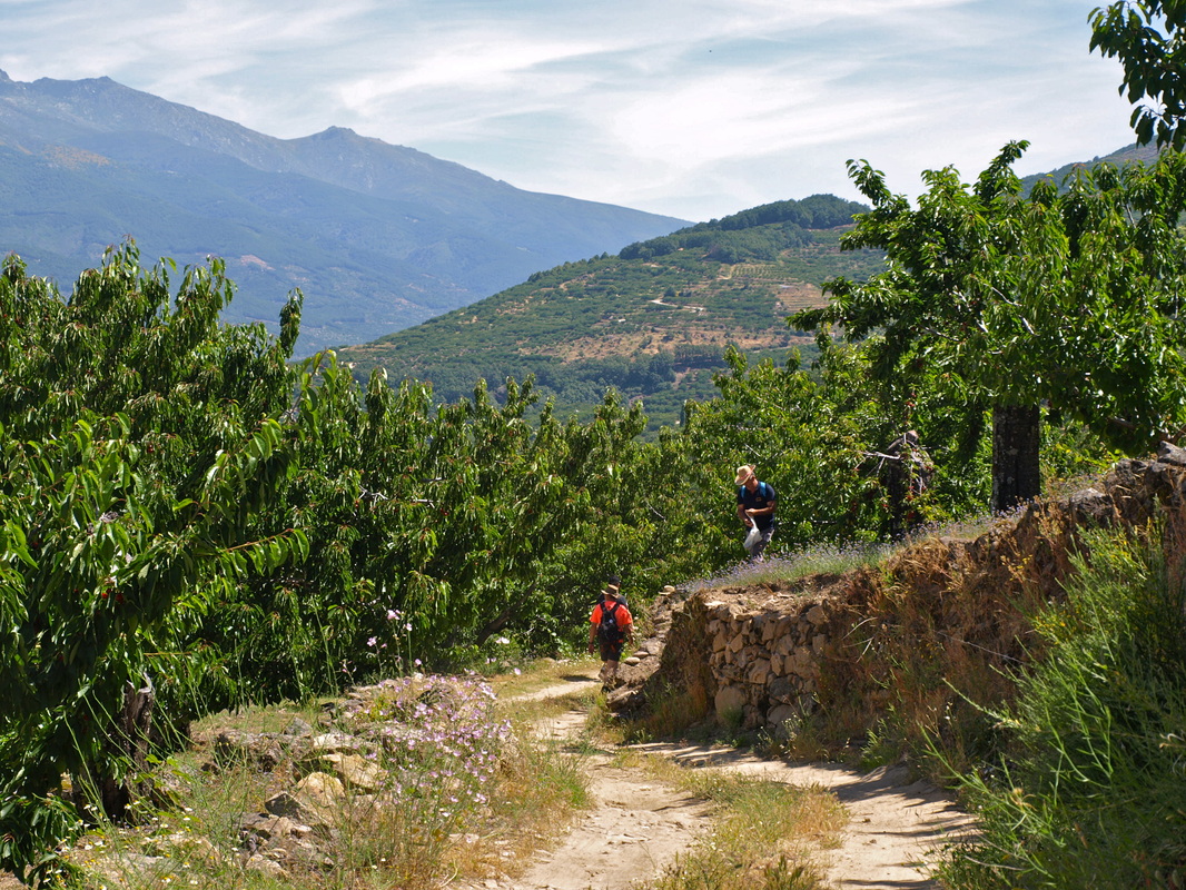
The cherry thieves
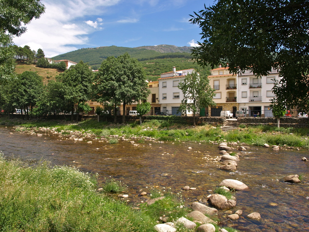
The River Jerte as it flows through Navaconcejo
|
The Walk of the Cherry Thieves
Information This easy, well-signposted walk goes downhill all the way from Piornal, the highest village in Extremadura at 1210m, to Navaconcejo on the banks of the River Jerte where everyone swims in the Summer. The first part of the walk goes through a huge deciduous wood of chestnut, oak and alder. The second part goes through extensive cherry orchards. In Spring it must be beautiful with cherry blossom. In Summer a walker can get very full eating cherries overhanging the paths. In Autumn the woods are full of colourful leaves but Winter might be difficult — there will be snow. Although the walk is easy it will make your calf muscles ache for a few days after — even if you are fit. For the really fit the walk can be up from Navaconcejo first and then, after a break in Piornal, back down. Otherwise the walk is linear. Enjoy the cherries! Start: from the entrance to Piornal Finish: in Navaconcejo Time: 3 hours Distance: 9.5 kilometres or 19 km out and back Elevation: lowest 450m, highest 1164m Difficulty: low going down, high going up Route: linear or out and back — map by Google Directions Take the N-110 Jerte Valley road from Plasencia. The road up to Piornal is the winding CV-17.3 but it is good, two-way and not difficult. Park at the entrance to the village in one of the side-streets opposite the Velatorio which is on the right. 1. N40º 07’ 09.0” W05º 51’ 10.8” With your back to the Velatorio, turn left and cross the road. Pass a signpost “Ruta Camino Real a Navaconcejo 10km 2hr 45” (It’s not really 10km.) Take the path, with a wooden fence on the left. It follows the CV-17.3 on the left. Beyond are views of the opposite side of the Jerte Valley with the villages of El Torno, 758m, left. and Robollar, 643m, right. On the right of the path are granite boulders with a profusion of wild flowers and bushes — even in late June. As the wooden fence on the left ends, the path leaves the road at a curve and plunges, right, into a wood. There is a white and yellow waymark here. 2. N40º 07’ 24.2” W05º 51’ 09.2” The path becomes earth and granite-paved. The wood is full of deciduous oaks, some chestnut and alder. Do not stray from the granite-paved path as it zig-zags and hairpins down through the wood with mountain views beyond. Occasionally there are wooden poles with a red arrow with two dots. These poles follow our walk but are for another route and we leave them later. Our real guides are the white and yellow waymarks. At a zig-zag by a collection of massive boulders, right, the path comes to a lane. Go left, cross the lane and go right to continue on the path. There is a waymark. 3. N40º 07’ 48.4” W05º 50’ 50.6” The sound of running water can be heard as the woods thin and more mountain views are revealed. It’s very pretty. Cross straight over a track that crosses the path. Pass a granite trough with water running from a spout above. It is drinking water. Opposite are the first cherry trees of the walk and great views. The sound of running water gets louder and the path drops down to quite a fast-flowing river. There is an information board about the area, various fountains with drinking water, a waterfall to the right and a medieval bridge to the left. 4. N40º 07’ 50.5” W05º 50’ 44.5” The path, concreted in places, continues around the head of the valley. On the left are views of the woods we came through but the trees are now thinner. There are still many flowering bushes with Spanish heath dominating the verges. Arrive at a junction; turn right. At the next junction, go left. Next junction, left and down. All these are very well sign posted. The deciduous oaks give way to chestnut and alder but, above all, to cherry trees. Cherries hanging over the lane are sample cherries ... in theory. Come to the place where we leave the red arrow and two dots posts. Here they indicate left along a rough track for motor cycle riders but the white and yellow markers tell us to go right. 5. N40º 08' 12.2" W05º 51' 11.4" Go right and continue down the concreted lane eating cherries as you walk. The lane goes down through an intensive cherry orchard area. Depending on the time of year there are people engaged in different activities. Everyone working in their orchards press yet more cherries on us ... The lane comes out at a main road. 6. N40º 08' 21.5" W05º 51' 02.7" Follow the white and yellow marker to turn left a few metres, cross the road, and turn right down a tiny footpath into a wood. The footpath is clear and goes past a stream on the left and continues in a horseshoe around the valley with the views on the left. Keep on the path. At a junction go right and up. 7. N40º 08' 59.0" W05º 50' 54.4" The track bends left. At a crossroads go right — there are two paths, choose the left one. The track is very steep and zig-zags down. At a T junction, turn right on to a concrete lane. At another T junction on the left is a white and yellow wooden post, PR 15. Turn left. 8. N40º 09' 44.7" W05º 50' 58.3" The village is below and right. Follow the lane as it bends right past another signpost and weekend houses on the left. The NV-110 is on the left and the lane meets it. Cross the main road with extreme caution. 9. N40º 10' 02.6" W05º 50' 45.7" Turn right and follow the track into the village. 10. N40º 10' 28.0" W05º 50' 21.5" The River Jerte is on the left and it’s tempting to stop for a swim in the hot months but go and get a drink first in one of Navaconcejo’s many bars, cafés and restaurants. If you’ve got the energy, the walk along the river, over the new white bridge, along the other side to cross the old bridge and the walk back through the historic town, is well worth the extra effort. Photos: June |