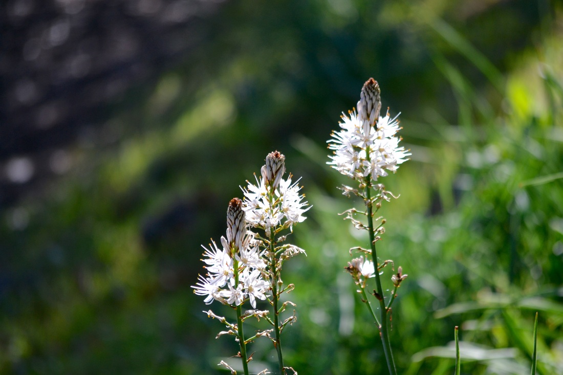
Asphodel Albus grows in the shade of the trees
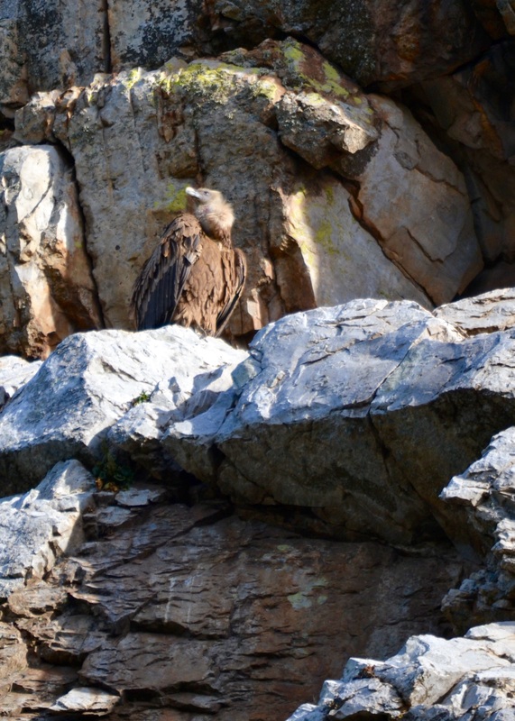
Near the castle in the craggy rocks eagles and vultures sit ... waiting ...
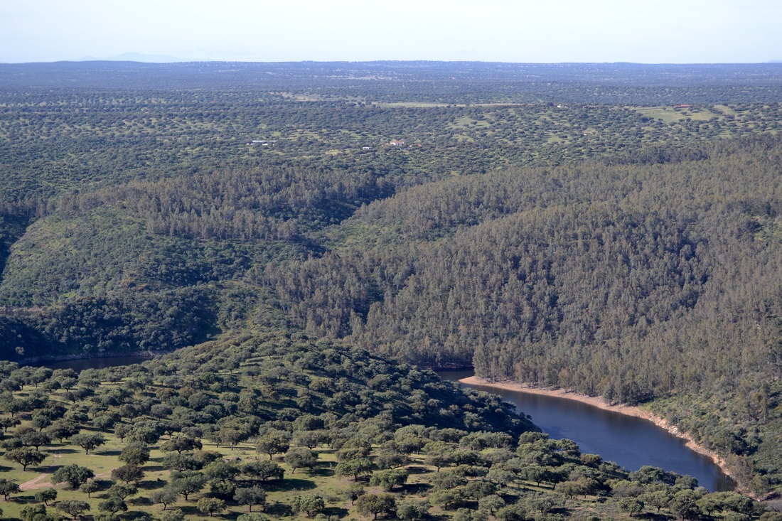
View north from the castle with the River Tajo below
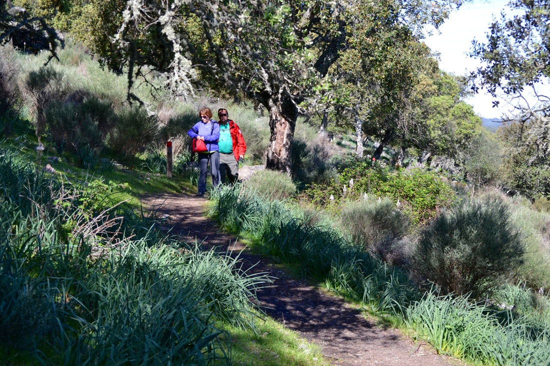
Much of the path is shaded and can be enjoyed all year
|
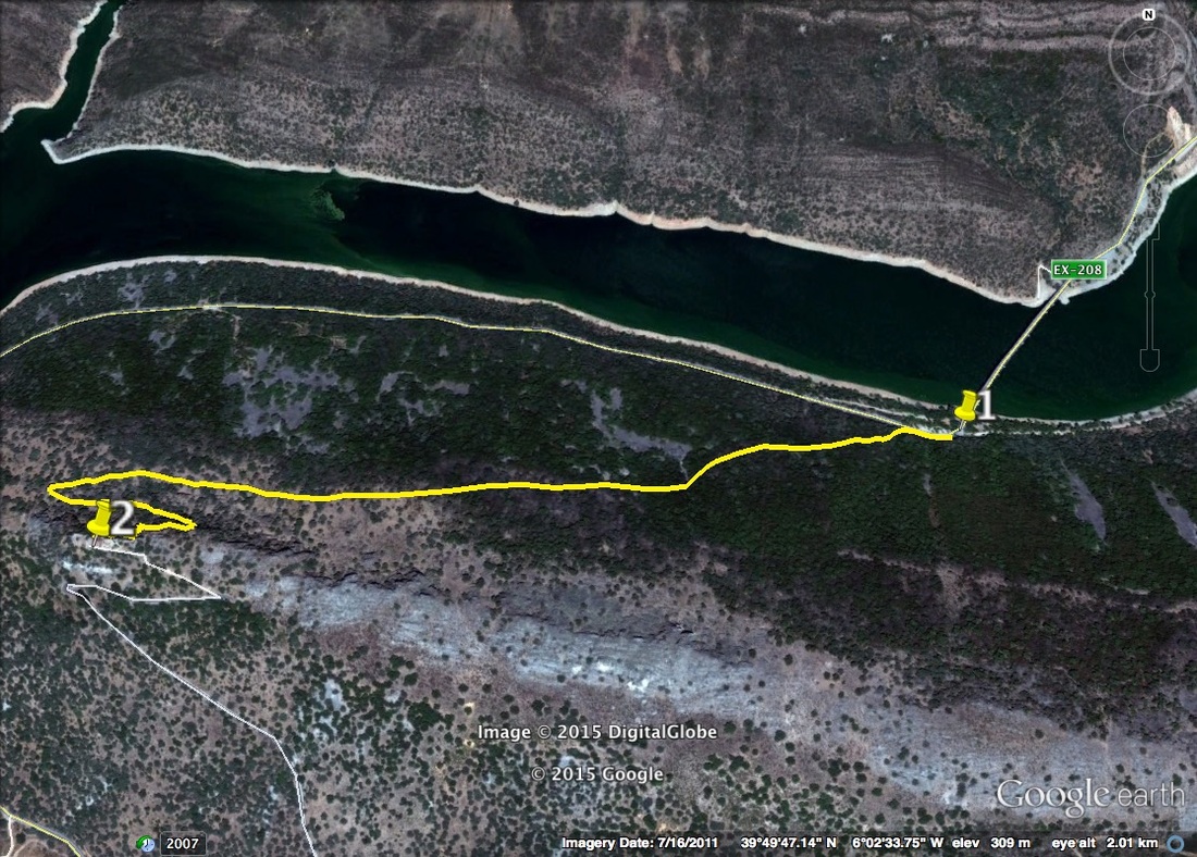
The Walk to the Castle
Information It almost seems a bit pointless posting a walk of only 4 kilometres but that would be to miss out on a really beautiful Monfragüe experience. For anyone driving down to the Sierra de Montánchez from Madrid Airport this walk makes a super leg-stretcher and breaks the car journey just nicely. There is a much longer walk sign posted in the park that takes in the Castle but not everyone wants to do 20 km, especially in the hotter months. This walk climbs relentlessly up from the Cardenal Bridge (which passes over the River Tajo on the EX-208 down from Villarreal de San Carlos). The top of the climb is at the Moorish Castle which overlooks the river and most of the park. The look-out point is spectacular for observing the larger eagles and vultures as they glide past above in the sky and below in the valley. Also, keep a look out for the craggy nooks on the sides of the peaks where birds nest. The path is soft earth but a little rough in places with granite or rocks but it is easy to walk. It passes through typical Monfragüe woods of ancient oaks that give shade and so can be walked year-round. There are flowering bushes growing under the trees and a wide variety of wild flowers on either side of the path. The bird song is beautiful. Once at the top of the climb there is a refreshment stop and they sell ice creams as well as drinks and snacks. There are picnic areas but please do not leave any rubbish. Use the bins. Start: by Cardenal Bridge where there is parking Finish: as above Time: 2 hours plus bird watching and exploration time Distance: 4 kilometres Elevation: lowest 235m, highest 430m Difficulty: medium going up, low coming down Route: out and back — map by google Directions Almost mid-way between the Salto del Gitano bird watching rock and the village of Villarreal de San Carlos lies the Cardenal Bridge on the EX-208. On the south side of the River Tajo, just before crossing the bridge in the direction of the village, is a car parking and picnic area. Park here. 1. N39º 49' 46'96" W06º 02' 07.11" Cross the road and look for a finger sign post that directs you into the bushes and on to the footpath that ascends up to the Castle. The footpath goes up, almost immediately. Follow the footpath as it ascends in a long and almost straight direction. As the Castle looms overhead, the path bends quite sharply around to the left and becomes steeper and a bit more rocky. The path bends sharply right and comes to the back of the Castle. 2. N39º 50' 13.81" W06º 02' 22.04" The Castle complex consists of various outbuildings and viewpoints but the best 360º viewpoint is from the top of the Castle keep. There is another way down from the Castle and for those who want a circular walk just follow the path at the front of the Castle. Descend the steep flight of steps and follow the lane down to the car park just before the EX-208. On the right is a path that cuts through the woods to arrive on the road near the Salto del Gitano. The rest of the way back to the start is, unfortunately, on the road. Take care. 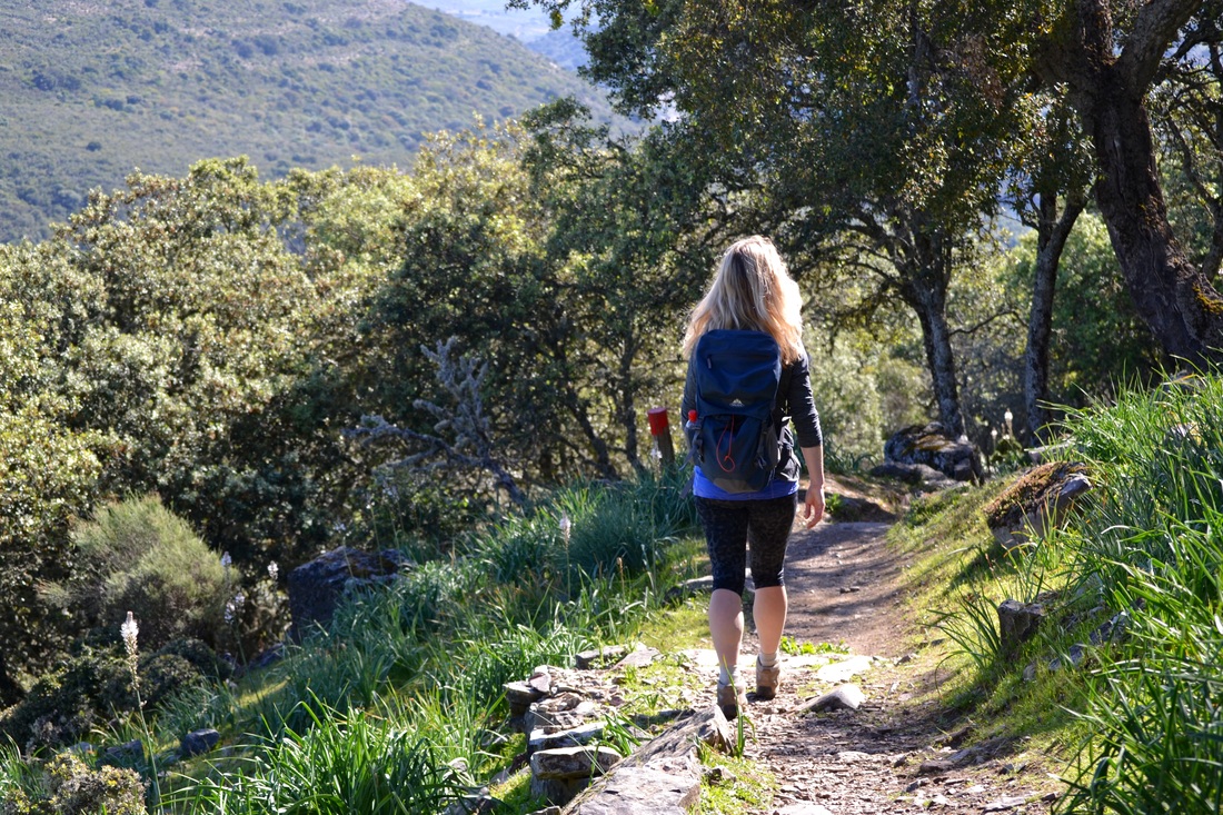
On the way back from the castle
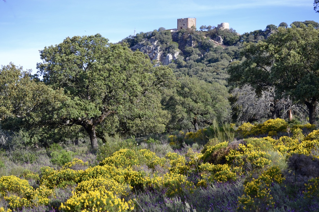
View of the castle from the return via the road
Photos: April and May
|