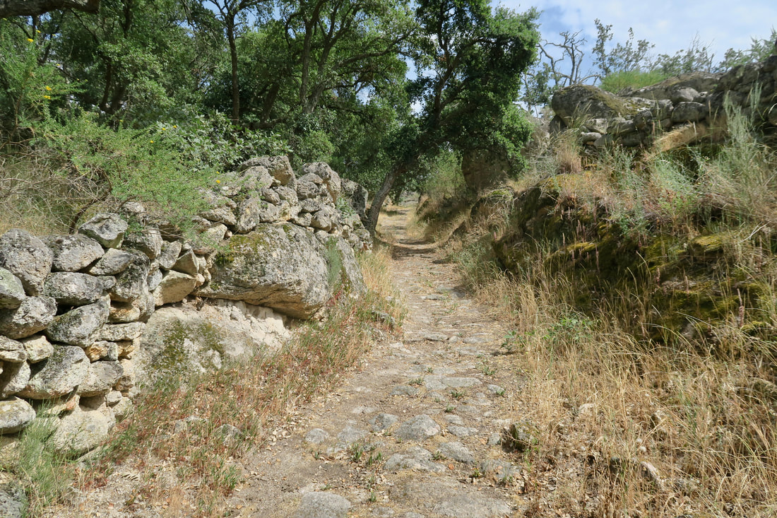
Footpath going down to the stream
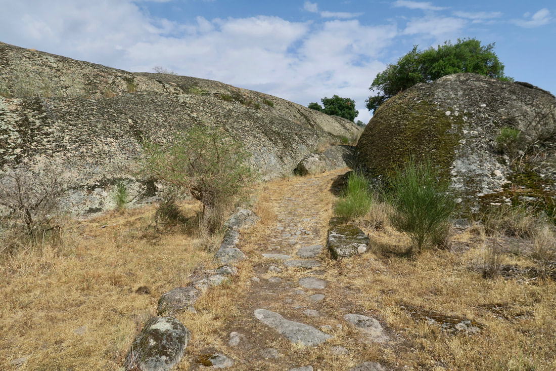
Near the top of the hill showing the giant boulders
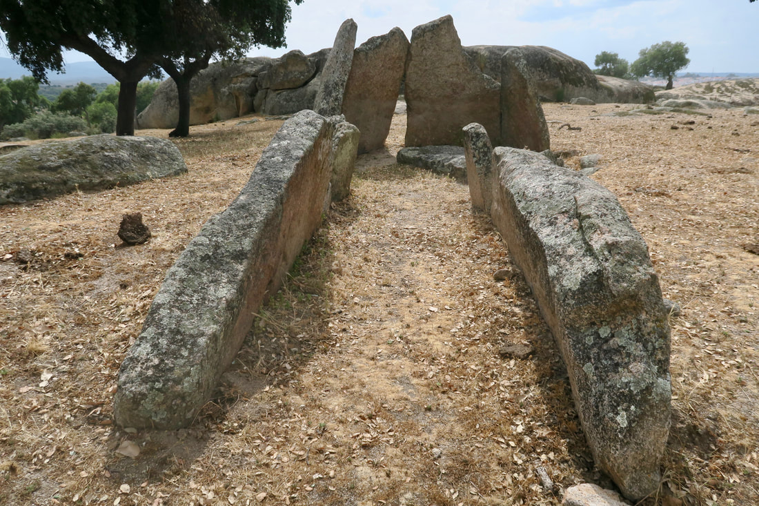
Zafra II
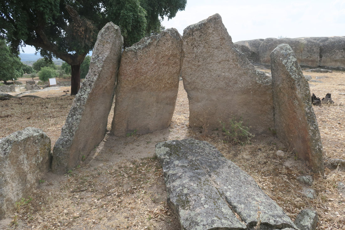
Zafra II showing the camera
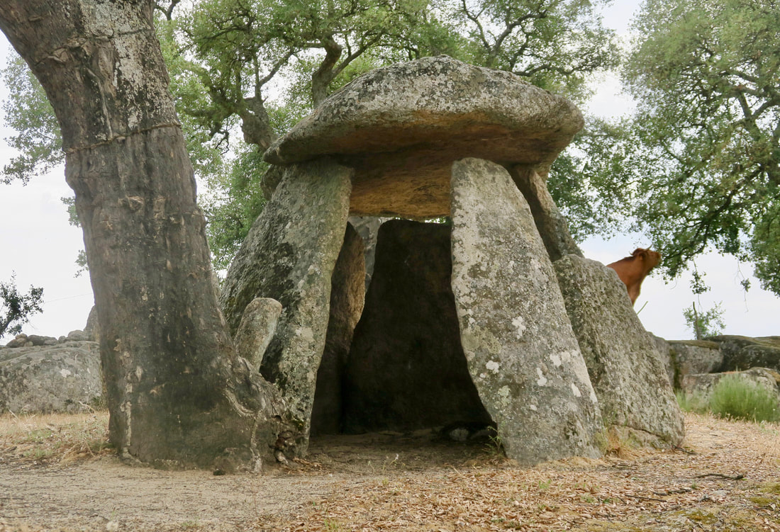
Zafra III (with cow eating olive leaves on right)
|
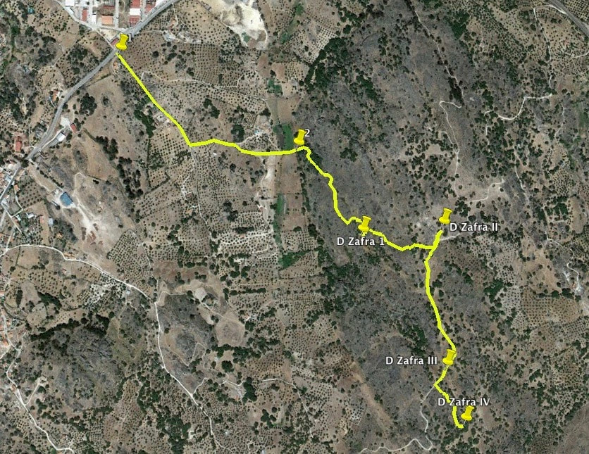
The Walk of the Zafra Dolmens
Information This short route starts along a well-made lane and turns into a footpath, crosses a stream and then climbs up to a granite elevation with good views towards Portugal. The highlight is the four dolmens, named after the person who 'discovered' them. The route is well-signposted throughout and each dolmen has its own information board in Spanish and English. There are cows grazing at the top of the hill and around the site of dolmens III and IV. They are lovely and gentle and well-used to people but DO NOT walk with dogs, even on a lead, nor approach the cows when they have calves. Park somewhere on the industrial estate on the right coming from Cáceres on the N-521 but before you reach Valencia de Alcántara. Cross the N-521 carefully — the traffic is usually quite fast in spite of bends in the road and the junctions into the industrial estate. Start: Valencia de Alcántara Finish: Valencia de Alcántara Time: 1.5 - 2 hours Distance: 5 kilometres Elevation: lowest 435m, highest 515m Difficulty: low for regular walkers Route: out and back — map by Google Directions The route is signposted at the start and there is an information board about the route and dolmens at the start. 1. N39° 24' 43.73" W07° 14' 00.71" Walk ahead on a well-made lane and pass a large house on the right. Pass a junction on the left but remember that this route is signposted throughout. If there are no signposts, walk straight ahead. The lane turns to the left by a large metal gate and becomes a footpath, occasionally covered in granite paving stones and sometimes soft earth. The path descends gently and narrows considerably. 2. N39° 24' 31.31" W07° 13' 35.91" Reach an area which may have high, lush vegetation in Spring or after rainfall. When I walked, (in May) the vegetation was higher than me. However, I walk with poles and parted the vegetation which is soft and without brambles. The stream bed was damp but, during rainfall there will be some water but the stream is not wide and can be crossed in one wide stride — unless it rains so much there are floods but that practically never happens. The path continues upwards and reaches an open area of impressive giant granite boulders, similar to those found in Los Barruecos. There are holm oaks, juniper trees, lavender and various brooms plus smaller flowers in season but the area has poor, thin soil; granite eroded over millennia. Overhead are raptors hunting for food. Continue upwards to reach a sharp left turn and then a signpost showing right, for Zafra I which is located in a lower area and one has to climb over a low wall to get close to it. N39° 24' 20.91" W07° 13' 27.55" The information board explains what can be seen. No artefacts or bones or even the tumulto have ever been found for Zafra I and it is thought that the dolmen had been looted many times over the years. Walk back to the signpost and walk right to get to more signposts showing left, Zafra II and, right, Zafra III and IV. Go left first to get to Zafra II crossing the cattle grid to get close. N39° 24' 21.02" W07° 13' 15.65" It is the largest of the dolmens and is very impressive. It is easy to walk into it and all around. The artefacts found in this dolmen, including objects made of jet, are on display in the Museum of Cáceres. The dolmen is situated on the highest ground in the area and probably this is not by chance. Return to the signposts and go right and over the cattle grid along a well-defined track to reach Zafra III on the right. N39° 24' 05.05" W07° 13' 16.86" This is a small dolmen, especially in comparison with Zafra II but it is well-preserved and quite emblematic of the dolmens in the Valencia de Alcántara area. Continue on for Zafra IV and its information board. N39° 23' 58.60" W07° 13' 14.82" Then retrace steps back to the start. Photos: May |