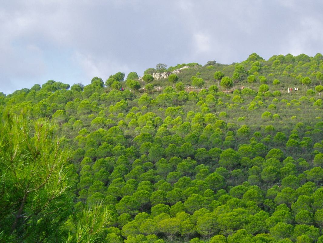
The track loops in gentle zig-zags up through the pine forest
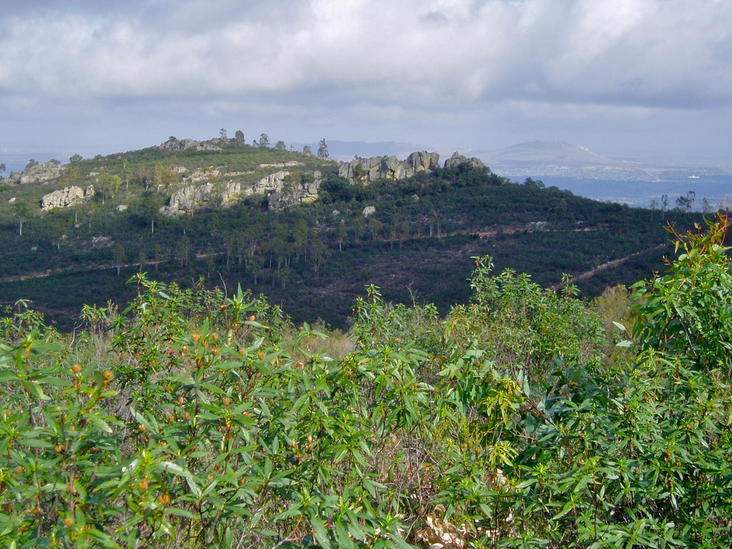
Just below the craggy ridge is the line of the track already covered
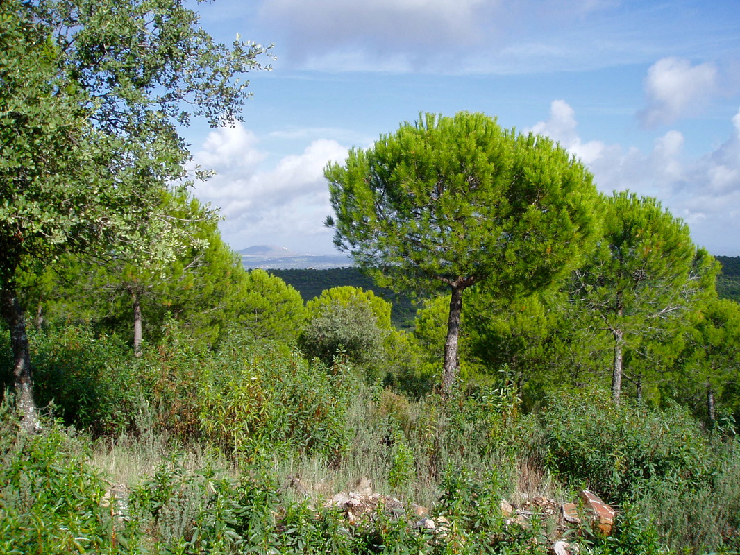
Mediterranean pines
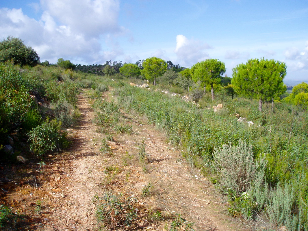
Looking back at low-growing flowering bushes dotting the verges of the track
|
The Walk of the Pine Forest
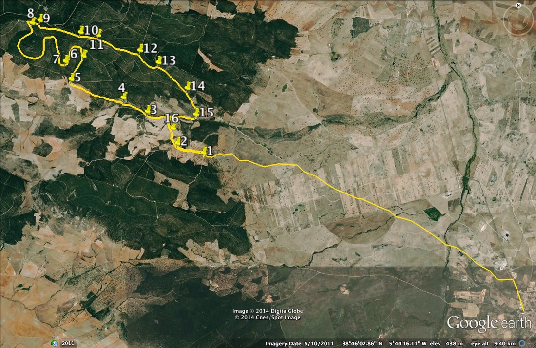
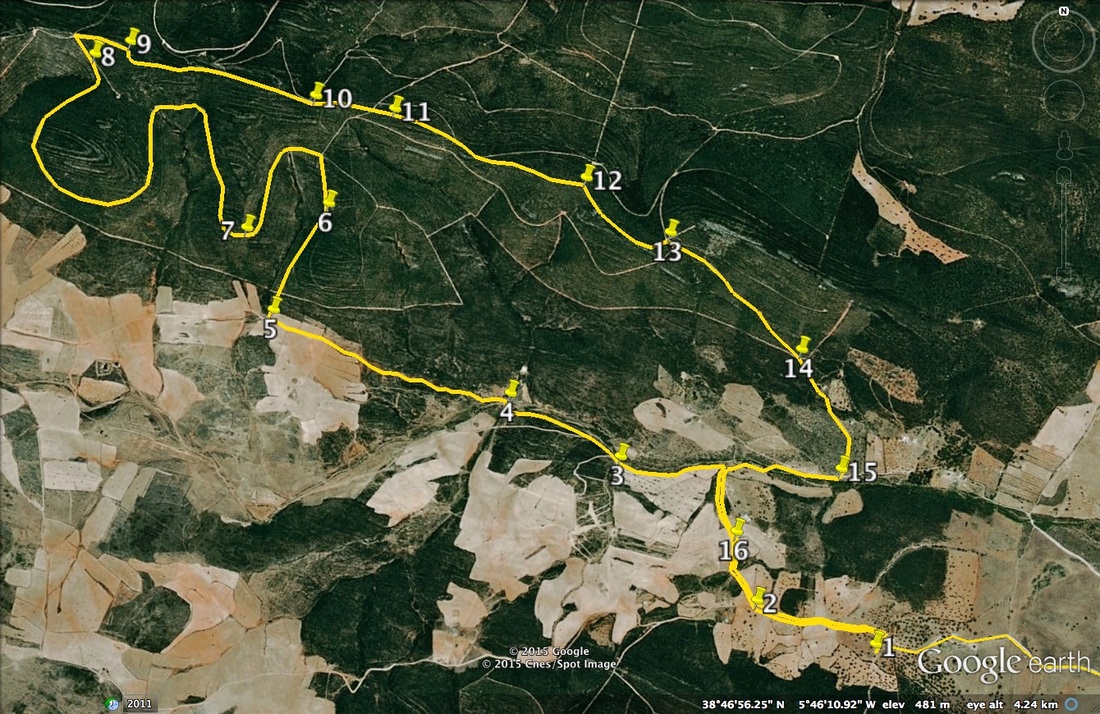
Introduction This walk is very pretty in the Spring when the millions of cistus bushes are in white flower and the lavender is purple. The constant features of the walk are the pine trees, the craggy sierra and the extensive views. The whole of the walk is on compacted earth tracks which can be damp in places after the winter rains. Start: 7.75km north-west of Quintana de la Serena Finish: as above in the same parking area Time: 4 hours Distance: 13.75km Elevation: 470m lowest, 655m highest Difficulty: medium Route: circular — maps by Google Directions From Quintana de la Serena travel north out from the town on the EX-114. Once outside the town take the first turning, left, on to a compacted dirt lane. If you get as far as the EX-346 on the right you have gone too far. Drive for 7.75km in a more-or-less straight north-westerly direction, crossing several fords. Park near a large agricultural building on the right and begin the walk. 1. N38º 46' 15.08" W05º 45' 11.10" With the agricultural building to your right follow a well-worn track due west. Take the first turning right to walk north-west. 2. N38º 46' 20.11" W05º 45' 33.09" Follow the track as it bends northwards. At a T junction turn left (the return is from the right). Follow the clear track as it starts to ascend towards the edge of a pine forest. The views are all out on the left hand side. 3. N38º 46' 40.86" W05º 45' 58.35" Continue gently upwards ignoring turnings on the left. The track makes a small bend right, and then left, but keep on the track. 4. N38º 46' 49.68" W05º 46' 18.88" The track goes up in a long straight direction. The walking is easy and allows plenty of time to take in the views on the left. Come to a major junction on the right. Go right. 5. N38º 47' 02.08" W05º 47' 02.46" Walk along this well-made track straight into the forest. The track bends slightly and just follow as it goes a little to the left. Look left. Over the treetops you can see the track we are going to take as it loops around the sierra. 6. N38º 47' 17.16" W05º 46' 52.11" Reach a crossroads. Do not go right. More-or-less straight on (but also a bit right) is a short cut to near GPS 11 to continue on from that point to reach the finish. However, we are going left to loop the sierra and do the walk properly to get the best views. Follow the track. Mixed in with the pines are occasional copses of eucalyptus. The ground cover is cistus bushes and lavender. 7. N38º 47' 13.55" W05º 47' 07.41" Continue as the track makes big loops and the views change with each change of direction. Look left and back for the line of the track we have already completed just under the craggy sierra heights. 8. N38º 47' 38.54" W05º 47' 35.32" Arrive at a crossroads. Turn right. Keep on this main track but there is a scrubby bit where you have to pick the way to not lose the track. Remember, the track ahead is more-or-less straight. 9. N38º 47' 40.33" W05º 47' 28.68" Keep ahead and ignore junctions on the left. 10. N38º 47' 32.57" W05º 46' 54.63" Keep straight ahead at a crossroads and continue. 11. N38º 47' 30.80" W05º 46' 39.86" Continue. Over on the left now are views out towards other villages in the Serena area with the distinctive hill of Magacela and its castle in the far distance 12. N38º 47' 20.80" W05º 46' 04.74" Reach a multiple junction. Go second right to start going down at a fairly steepish gradient. To the next GPS point is 800m but the descent is 70m. The track is in good condition and allows chances to keep an eye on the views ahead. 13. N38º 47' 13.06" W05º 45' 49.17" At the next junction, a vague crossroads, keep ahead. 14. N38º 46' 55.80" W05º 45' 24.99" The track continues downward. At a T junction turn right. 15. N38º 46' 38.90" W05º 45' 17.69" Take the next junction, ahead is the start of the circle we have just completed around the sierra. Take the left track. Retrace steps back along the track towards where the car is parked. 16. N38º 46' 29.94" W05º 45' 37.04" Photos: December |