The first book in English on Walking in Extremadura has now sold out! However, it is a plan to revisit and revise the walks and information in this book and republish it in the Autumn.
ISBN: 978-84-89954-95-3
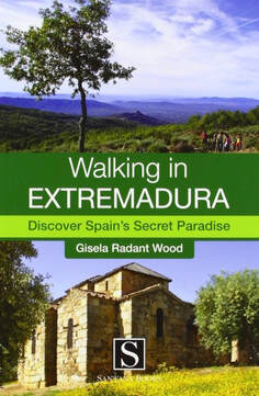
Format: 18cm x 12cm
350 colour pages and over 100 photos
Publication Date: October 2012
Each of the seven chapters has an introduction to the geography, history and natural environment of the area in which the walks are set. There are walks for every level of fitness and range from 3.5km all the way to a possible 50km of linked routes set in the Sierra de Gata. If you like your walking flat, routes start at 305m above sea level but there are climbs up to 1,487m for walkers who like a challenge. In addition to the 27 fully described walks, with IGN maps and GPS points, there are three historic city walks in Mérida, Cáceres and Trujillo, showing you the best of these cities, PLUS a further 20 suggested, named and signposted countryside routes.
Any changes to the routes will be posted here and updated as and when necessary. No post means no change.
The updating will continue even though this book is now out-of-print. Work has started (February 2025) on revising and updating the walks in the book with a view to republishing the book later in 2025.
Chapter 1 The Sierra de Montánchez
Walk 3
Between GPS 8 and GPS9, when you reach the small footpath it is blocked off by tree branches. Walk ahead into the finca just to the right of the footpath— there is no gate — and walk ahead, then turn left to descend the terrace. Hug the wall on the left. Turn left to pass through the dry stone wall into the footpath (that has been blocked further up). Continue with the walk as described in the book. Updated 17.12.2017
This part of the walk is getting more and more inaccessible but there is an alternative. Just by the huge granite water troughs between GPS 7 and GPS 8 turn left down the small track. Follow this track as it descends straight down to the small back road, the CC-160. Cross the road and you are at GPS 10. Continue the walk. Updated 27.02.2018
Walk 4
From 900 metres after GPS 4 up to the junction with the village, the footpath has been concreted. The verges have been left with bushes and flowers!
Chapter 2 The Roman Waters
Walk 1
The chiringuito, Lago Pinar, has been shut for several months. The owner retired and the new owners are not yet up-and-running. However, further to the south-west, just past the Red Cross station, is another café/restaurant with facilities and parking opposite. It is called Yuyu and open every day throughout the year. The food is good and they have a lovely terrace overlooking the water. (Posted 2.11.2019)
Walk 3
Between GPS 7 and 8, at the signpost indicating ‘Pinar Los Valencines’ the metal gates are locked. Walk the short, 8km, version of this walk only.
Chapter 3 The Sierra de Gata
Walk 2
Either follow the text or the map but for 500m the two do not coincide. After GPS4 “... come to a Y junction. Stay on the lane and ignore path, left” is correct (page 173). The line on the map shows the path going left to GPS6. You can go either way and won’t get lost but the text is the best guide. Additionally, GPS6 is correctly listed (page 177) but the position on the map is wrong. It should be 200m due west of GPS5.
Walk 4
A few of you have contacted me to say Calle del General Franco doesn’t exist. Yesterday I checked it out. It’s true. Calle de la Iglesia has replaced Calle del General Franco. This is because Spain is slowly renaming everything ‘Franco’. Here follows more specific starting directions ...
Start in the Plaza Mayor in San Martín de Trevejo. With the Town Hall porch on your right, walk straight ahead and up Calle de la Iglesia. Ahead is the church. Pass the church with it on your left. Turn first right. Have a quick look behind you. You should see the back of the church and a sign for Calle del Puerto. With your back to the church and the sign, walk straight up the road ignoring all junctions. Come to a T-junction and a sign pointing left for 'Calzada Romana’ ‘Sendero Puerto Santa Clara'. Go left. Walk straight up this wide lane. (Continue with the walk as described in the book).
Chapter 4 The Sierra de Gredos and La Vera
Walk 2
The church on page 240 is called San Agustín and not Santa María de la Torre.
Chapter 5 Monfragüe National Park
Chapter 6 Las Villuercas
Walk 2
This walk has been recently signposted in white and red. Between GPS3 and GPS4, once past the rockfall continue on the path to reach a cattle grid. Go straight over this cattle grid and follow the track as described in the book. Updated 17.12.2017.
Chapter 7 City Walks
Walk 1 Revised and updated and posted on this site under 'The Walks, City Walks, The Walk of the Roman Citizen (Mérida)'
Walk 2 Revised and updated and posted on this site under 'The Walks, City Walks, A Walk in a Renaissance City (Cáceres)'
Walk 3 Revised and updated and posted on this site under 'The Walks, City Walks, A Walk with Conquistadores (Trujillo)'
ISBN: 978-84-89954-95-3
Format: 18cm x 12cm
350 colour pages and over 100 photos
Publication Date: October 2012
Each of the seven chapters has an introduction to the geography, history and natural environment of the area in which the walks are set. There are walks for every level of fitness and range from 3.5km all the way to a possible 50km of linked routes set in the Sierra de Gata. If you like your walking flat, routes start at 305m above sea level but there are climbs up to 1,487m for walkers who like a challenge. In addition to the 27 fully described walks, with IGN maps and GPS points, there are three historic city walks in Mérida, Cáceres and Trujillo, showing you the best of these cities, PLUS a further 20 suggested, named and signposted countryside routes.
Any changes to the routes will be posted here and updated as and when necessary. No post means no change.
The updating will continue even though this book is now out-of-print. Work has started (February 2025) on revising and updating the walks in the book with a view to republishing the book later in 2025.
Chapter 1 The Sierra de Montánchez
Walk 3
Between GPS 8 and GPS9, when you reach the small footpath it is blocked off by tree branches. Walk ahead into the finca just to the right of the footpath— there is no gate — and walk ahead, then turn left to descend the terrace. Hug the wall on the left. Turn left to pass through the dry stone wall into the footpath (that has been blocked further up). Continue with the walk as described in the book. Updated 17.12.2017
This part of the walk is getting more and more inaccessible but there is an alternative. Just by the huge granite water troughs between GPS 7 and GPS 8 turn left down the small track. Follow this track as it descends straight down to the small back road, the CC-160. Cross the road and you are at GPS 10. Continue the walk. Updated 27.02.2018
Walk 4
From 900 metres after GPS 4 up to the junction with the village, the footpath has been concreted. The verges have been left with bushes and flowers!
Chapter 2 The Roman Waters
Walk 1
The chiringuito, Lago Pinar, has been shut for several months. The owner retired and the new owners are not yet up-and-running. However, further to the south-west, just past the Red Cross station, is another café/restaurant with facilities and parking opposite. It is called Yuyu and open every day throughout the year. The food is good and they have a lovely terrace overlooking the water. (Posted 2.11.2019)
Walk 3
Between GPS 7 and 8, at the signpost indicating ‘Pinar Los Valencines’ the metal gates are locked. Walk the short, 8km, version of this walk only.
Chapter 3 The Sierra de Gata
Walk 2
Either follow the text or the map but for 500m the two do not coincide. After GPS4 “... come to a Y junction. Stay on the lane and ignore path, left” is correct (page 173). The line on the map shows the path going left to GPS6. You can go either way and won’t get lost but the text is the best guide. Additionally, GPS6 is correctly listed (page 177) but the position on the map is wrong. It should be 200m due west of GPS5.
Walk 4
A few of you have contacted me to say Calle del General Franco doesn’t exist. Yesterday I checked it out. It’s true. Calle de la Iglesia has replaced Calle del General Franco. This is because Spain is slowly renaming everything ‘Franco’. Here follows more specific starting directions ...
Start in the Plaza Mayor in San Martín de Trevejo. With the Town Hall porch on your right, walk straight ahead and up Calle de la Iglesia. Ahead is the church. Pass the church with it on your left. Turn first right. Have a quick look behind you. You should see the back of the church and a sign for Calle del Puerto. With your back to the church and the sign, walk straight up the road ignoring all junctions. Come to a T-junction and a sign pointing left for 'Calzada Romana’ ‘Sendero Puerto Santa Clara'. Go left. Walk straight up this wide lane. (Continue with the walk as described in the book).
Chapter 4 The Sierra de Gredos and La Vera
Walk 2
The church on page 240 is called San Agustín and not Santa María de la Torre.
Chapter 5 Monfragüe National Park
Chapter 6 Las Villuercas
Walk 2
This walk has been recently signposted in white and red. Between GPS3 and GPS4, once past the rockfall continue on the path to reach a cattle grid. Go straight over this cattle grid and follow the track as described in the book. Updated 17.12.2017.
Chapter 7 City Walks
Walk 1 Revised and updated and posted on this site under 'The Walks, City Walks, The Walk of the Roman Citizen (Mérida)'
Walk 2 Revised and updated and posted on this site under 'The Walks, City Walks, A Walk in a Renaissance City (Cáceres)'
Walk 3 Revised and updated and posted on this site under 'The Walks, City Walks, A Walk with Conquistadores (Trujillo)'