|
The Walk of the Mine and the Roman Theatre
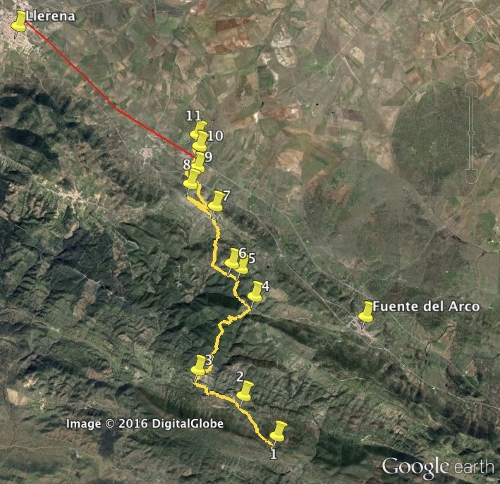
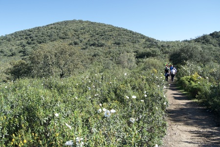
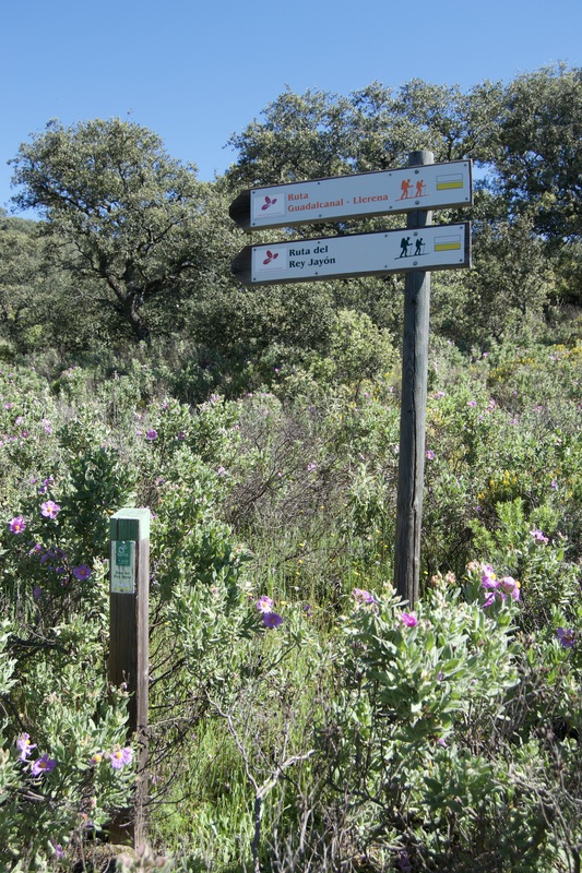
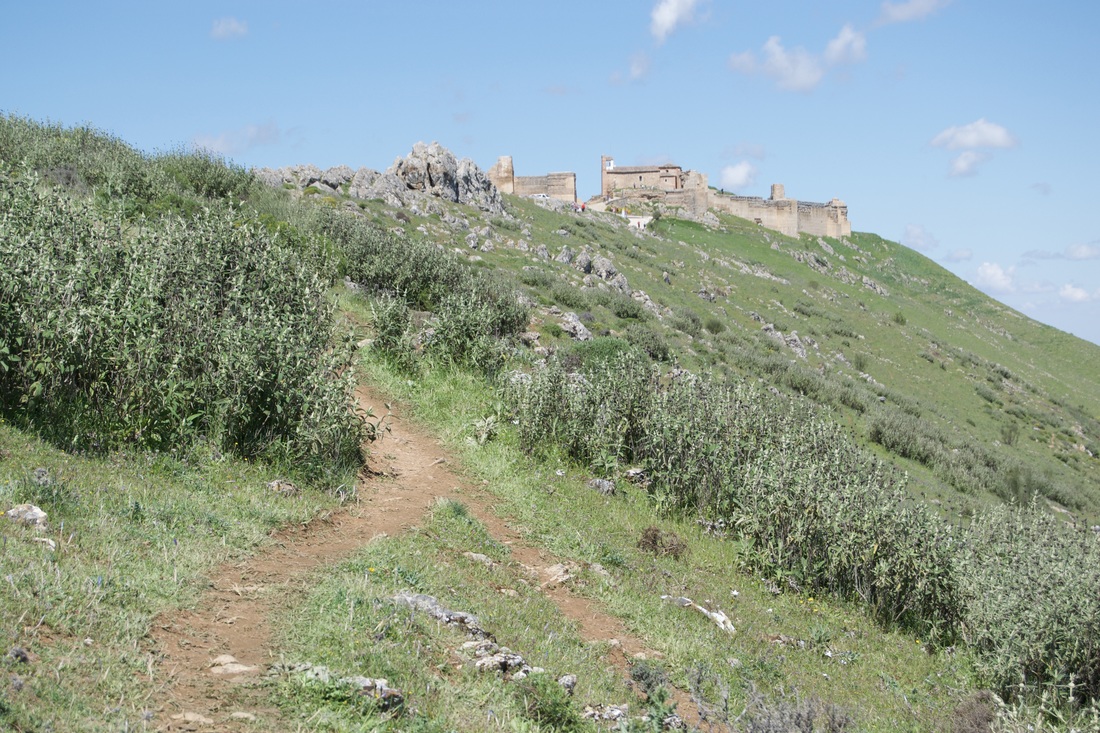
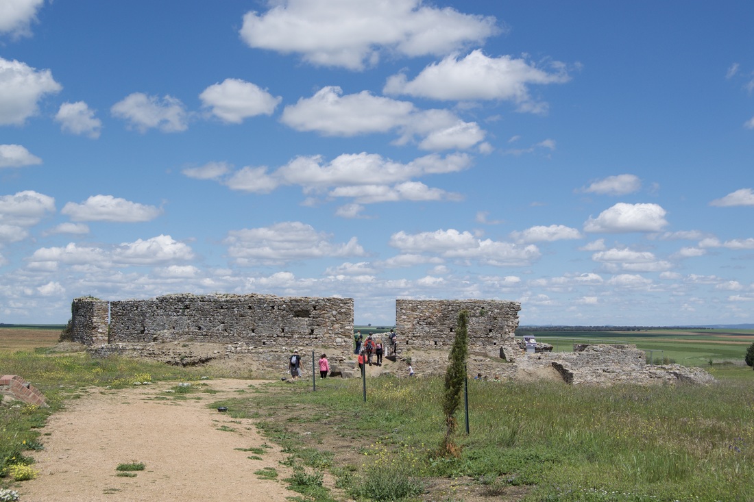
Information This walk is in the south-east of Badajoz province. It starts at the open-air museum of the Mina la Jayona which was an ancient place for extracting iron. It is well signposted but guides are available to explain the mine. The walk continues to the Hermitage of the Virgin of Ara with it's impressive wall paintings. Then there is a climb over the end of the Sierra del Viento, through copses of trees and bushes in flower in the Spring. The walk ends in the small town of Reina where there is a hill-top Alcazaba and the remains of a small, but important, Roman Theatre. To do this walk you will need to be dropped off at the entrance to the mine, where there is a car park. It can be accessed via Fuente del Arco which is on the same road as Reina, the EX-200. Then arrange to be picked up from Reina. Or continue the walk into Llerena which is another 7km. Start: The car park at the Monumento Natural Mina de Jayona Finish: Reina Time: 5 hours plus stops Distance: 15.25km Elevation: lowest 495m, highest 813m Difficulty: medium Route: linear — map by Google Directions Start in the car park below the mine. 1. N38º 07' 11.91" W05º 55' 44.28" Walk up the hill on the concrete track to the Visitor Centre and toilets. Continue on the track as it goes up steeply through pine trees to reach the different levels to enter the mines. At the top of the mine, to the left, walk up the steps and path with railings on the right and views into the mine. At the top of the climb the path converts into a wider compacted earth track and gently descends through olive groves. Ahead is a distant view of the village of Reina with the Alcazaba on the hill to the right. This is our destination. The views around are of wooded rounded hills and soft valleys. The Hermitage of Our Lady of Ara comes into sight. 2. N38º 07' 52.27" W05º 56' 24.22" Enter into the grounds by way of a small gate on the left. There are toilets to the right. If the place is open it is well worth exploring for the fine wall and ceiling paintings. Continue on the walk by turning right once out of the hermitage. Pass an old cortijo on the right as the path bends, naturally, to the left. Enter a more shady area with oak trees and a few eucalyptus. Pink cistus bushes dominate the verges in Spring. Reach a Y-junction. 3 N38º 08' 18.07" W05º 57' 20.50" Left is a white and yellow waymark but an orange arrow directs the way right, through a make-shift gate. Leave it the way you found it. The path ascends on a rough dirt track which narrows and winds upwards. Bushes reach head height and encroach slightly. Reach an open space with an unfenced meadow on the right. The path bends left and continues upwards. Pass through a second gate which announces it is private property. However, walkers can walk the route but must not stray from the path or walk with dogs. Pass an abandoned house on the left tucked into the finca. The path reaches a point at which it starts to descend. On the right is a huge but soft valley and the path follows the line of the ridge all along the valley. Come to a wider dirt track that naturally bends right, still around the valley, with glimpses of the track ahead winding into the distance. Pass a low chain strung across most of the track. This is to deter motorbikes. The track continues and the sides of the hills are covered in thousands of flowering cistus bushes. Reach a weekend house, an impressive oak and a small thatched building, all on the left. 4. N38º 09' 30.49" W05º 56' 06.92" Here the walk leaves the track and turns left, between some gates to continue ahead with the buildings on the right. Pass a home-made gate and continue ahead. Dogs may bark but they are tied up. The owner allows walkers and the path is well-used. The path is soft earth and a bit windy and up and down. After 50m it drops to the right to hug the fence on the right. Pass through another gate to pick up a wall on the right. Continue and pass through a gap in a fence where the path becomes a bit wider. It bends right and a wooden plank bridge crosses a small stream. The views are of a lovely wooded hill on the left. Pass a small ruin on the left. Reach a wide dirt track. Cross over and continue on the footpath on the other side of the track. Turn left to cross a stream and ascend on the other side. 5. N38º 09' 58.44" W05º 56' 23.06" Keep going up to reach a signpost ‘Ruta del Rey Jayon’ and a lovely view all around. At a Y-junction a track comes up from the left to join our track which goes right. There are two signposts “Ruta del Guadalcanal” and “Ruta del Rey Jayon”. 6. N38º 10' 03.84" W05º 56' 34.53" Reach a track. On the right is a gate to a finca. On the left is a wide track. Straight over is a concreted track. There are signposts. Take the track straight ahead. The concrete quickly gives way to a compacted track that ascends quite steeply. Ahead is a view of the Alcazaba and the village. Follow the track to the village. Reach a concrete lane. 7. N38º 11' 00.84" W05º 56' 53.52" Turn left on to a tarmac road, turn right at an acute bend, then first left. Follow this lane steeply upwards as it zig-zags to the sign for the Alcazaba. Turn left and follow the footpath all the way up to the Alcazaba. the views all around are extensive, including of the distant Roman Theatre. Watch for swooping birds. Reach the Alcazaba and explore. There are information boards in Spanish and English. 8. N38º 11' 23.31" W05º 57' 23.58" After exploring leave the Alcazaba by the paved road that descends all the way to the village. Turn left on a tarmac road. The Alcazaba is high up on the left. Walk through the village but stay on the lane, do not go upwards at the Y-junction. At the end of the lane reach a junction at Calle Iglesias. Keep straight on to a the track which drops down to the EX-200 main road. Cross the road and turn left. 9. N38º 11' 39.65" W05º 57' 14.28" At the slip road signed Teatro Romano de Regina 1km turn right. Follow the road all the way to the theatre, keeping right at the only Y-junction on the road. This is the minor road that goes straight to Llerena. It is 7km and coloured red on the Google map. 10. N38º 12' 00.68" W05º 57' 10.83" Turn left into the theatre and turn right into the car park and buildings. The information boards are in Spanish and English. 11. N38º 12' 12.43" W05º 57' 13.50" Photos: April |
