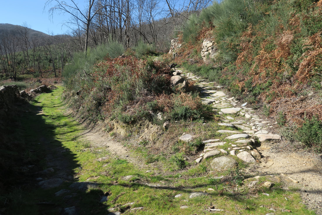
The cobbled track on the right is the right one to chose
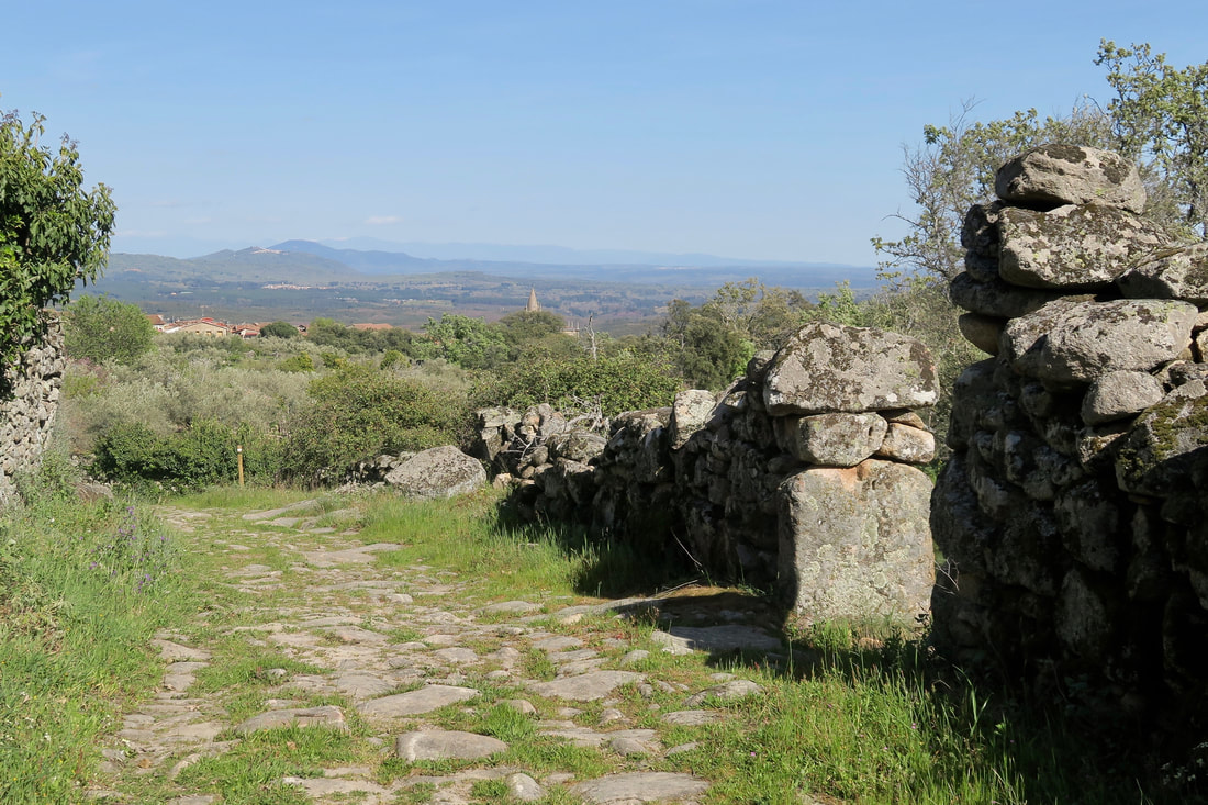
Look back to view the Sierra de Gredos in the distance and the spire of the church in Hoyos
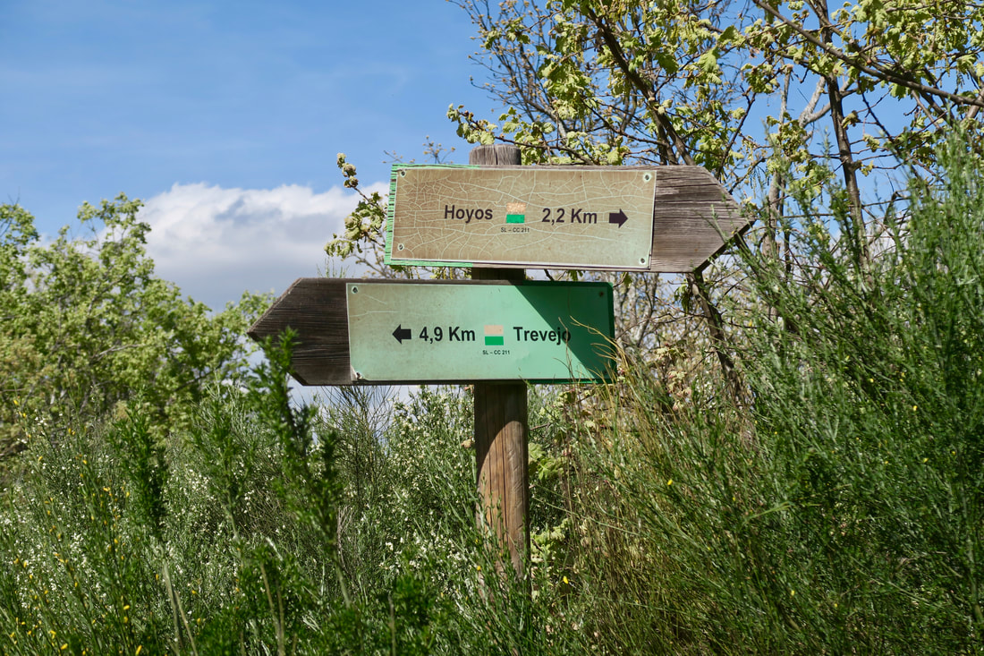
Signposts at the top of the climb — GPS 2
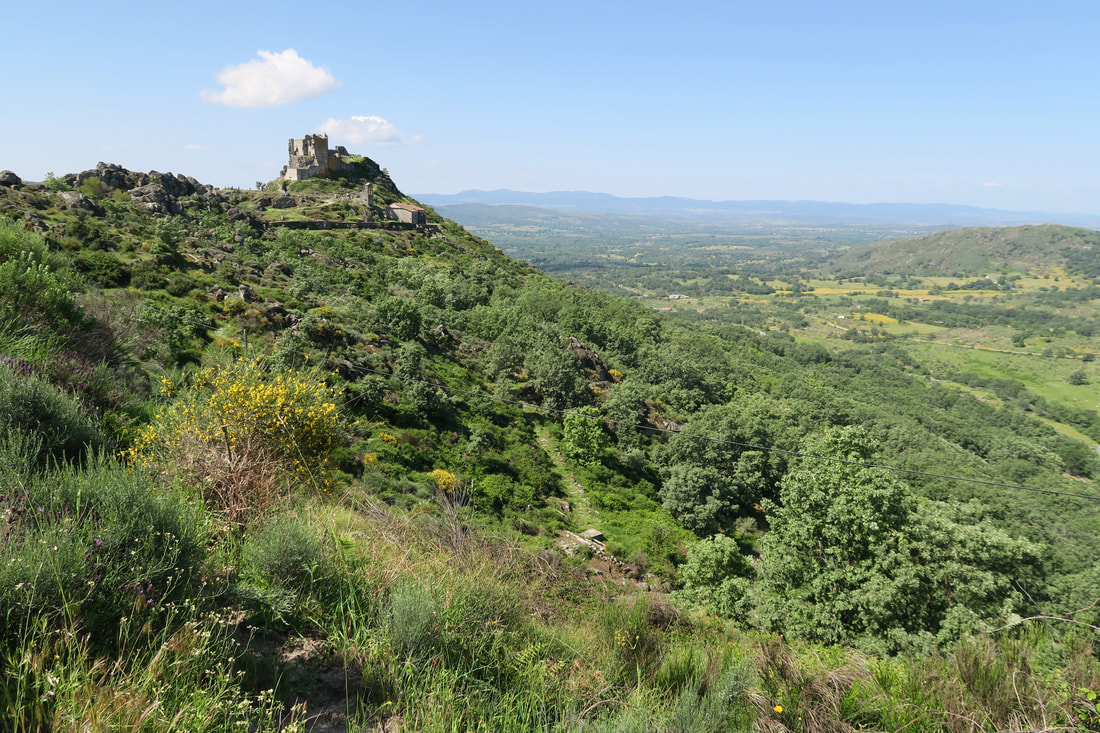
Trevejo Castle
|
Hoyos to Trevejo
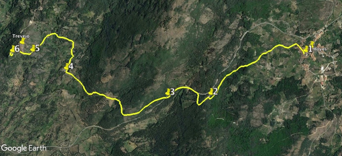
Information This route is the SL-CC-211 and is waymarked with white and green flashes and the occasional finger signpost. It links the village of Hoyos, with its important historical centre, with Trevejo, a tiny granite village with a ruined castle, from which there is a stunning view over the surrounding countryside. Much of the walk passes through woods and farming countryside. The latter part of the route is on the famous GR10. The walk is linear but at only 7.50km the out and back version is easy. Hoyos is well off for cafés, especially El Redoble near the road into Hoyos but Trevejo has only one bar with very mysterious opening hours. Take water. Start: Hoyos Finish: Hoyos Time: 5 hours including exploring time Distance: 15 kilometres (to castle and back included) Elevation: lowest 514m, highest 733m Difficulty: medium Route: out and back— map by Google Directions Start in the Plaza Mayor in Hoyos. 1. N40 10' 15.80" W06 43' 18.03" Turn in a northerly direction to find Calle Obispo Alverez de Castra and walk all the way up this gently rising street to take the last turning on the left just before the village ends. This track is the Camino Viejo de Villamiel. On the right, a few metres along the track, is an information board about the walk. In season there are a boggy few metres near the start but these are not difficult to negotiate as there are stepping stones. Keep on the track, which has regular paving slabs of ancient granite, as it passes agricultural fincas of olives with grazing sheep and goats. Ignore all junctions to the left and right. Enter the woods. Arrive at a distinct Y-junction and take the right path that climbs gently up into the woods.The verges on either side are full of flowers, even as early as February. Keep going up to make a sharp, natural, right bend in the path. The path widens slightly and comes out on to a concrete track. Turn left and walk towards two finger signposts on the left (Hoyos to Trevejo). 2. N40 9' 54.12" W06 44' 30.16" Once by the signposts walk towards the lane ahead. Do not take the first left track. take the second left and follow it around in a half loop to reach the small back road, EX-205. Turn left and walk alongside the road to reach a waymark — approx: 600m. Cross the road and enter the woods by a narrow footpath marked by another waymark. 3. N40 9' 54.44" W06 45' 1.15" Keep on this footpath as it goes through the woods. Come to more open views and follow the path as it bends 90 degrees to the right. Reach a T-junction where the path joins the GR10 from Cilleros to the left (10.9km) to Trevejo to the right (1.6km). There are signposts. The view above is of Trevejo Castle and the village of the same name. Turn right. 4. N40 10' 9.86" W06 46' 14.83" Keep on the track, now cobbled, as it loops left and left again. In June and July the verges are thick with foxgloves and mallows. Pass the Ermita del Cristo on the left. It's plain but the village was poor when they built it. 5. N40 10' 20.74" W06 46' 36.94" Continue going up more steeply to reach the village. Wind the way up to get to the 'main' street. Turn left for the Castle and the views. 6. N40 10' 20.71" W06 46' 50.52" Turn right for, maybe, the bar which, maybe, might be open. If not, drink your water and eat your sandwiches at the picnic area and retrace steps back to Hoyos. Photographs: February, April, July. |