|
Eljas Morning Glory
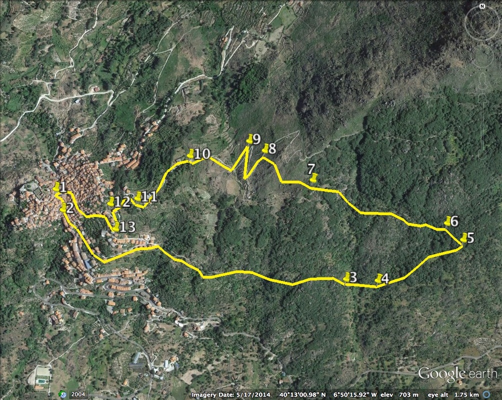
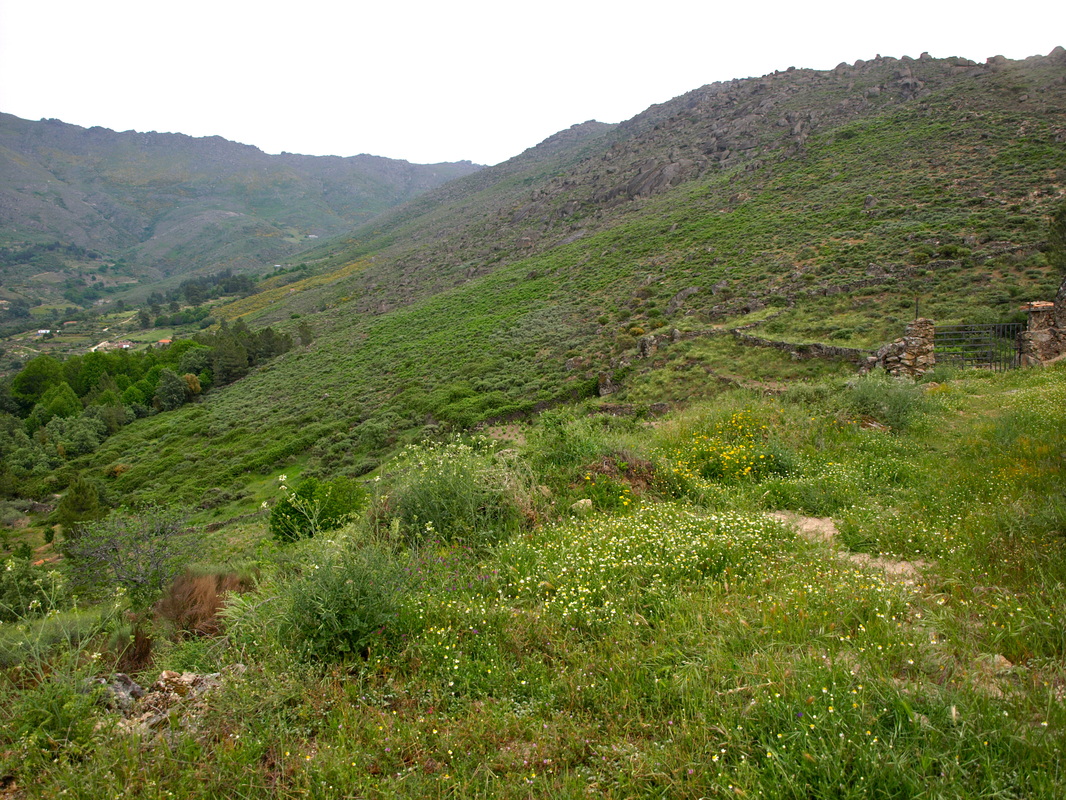
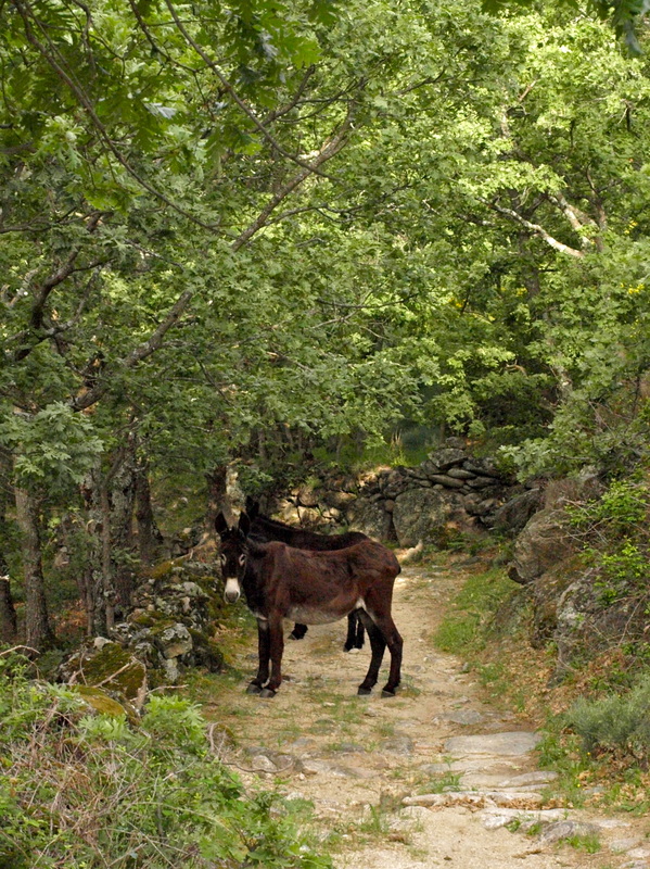
Information This walk has been contributed by John Smyth, ex-Fleet Street journalist and walking enthusiast. A fine morning stroll along the east face of the mountains behind Eljas. Pass trees, flowering bushes and immense granite boulders. Take in panoramic views of the beautiful Jálama valley, on the right going out and the left on return. Start: Eljas Finish: Eljas Time: 2.5 - 3 hours Distance: 5 kilometres Elevation: lowest 615m, highest 733m Difficulty: frequent but moderate ascents and descents Route: circular — map by google Directions From Eljas Plaza de la Constitución 1. N40° 13’ 01.66” W06° 50’ 49.16” with the Town Hall on your right, turn right into Calli as Parras. After 200m, at a stone house with wooden shutters, turn left into Calli Tabolau. Turn first right at 2. N40° 12’54.79” W06° 50’ 33.27” The made-up road becomes a dirt road flanked by terraces of olives and figs. After 170metres, at an electricity pylon marked CC13110, turn left and climb past fincas on a steepish, granite path. This leads to a spectacular part of the mountain range where massive boulders appear to have rolled part-way down the slant then become wedged, defying gravity, sometimes one on top of another. The track climbs and falls over rocks and granite ground up like sand, flanked by oak trees, ferns and wild flowers which have sought out soil in this garden of stone. Occasionally there are terraced fincas of olives. Take a bird’s-eye view of the valley below. Descending to 3. N40° 12’ 50.81” W06° 49’ 49.95” fork left uphill. DO NOT drop right. Watch out for a boulder at 4. N40° 12’ 52.04” W06° 49’ 47.79” where the stone wall on the right is low enough to scale. Hop over into a field of oaks and hug the left-hand side of the wall, along a faint grass trail, for around 180metres (to avoid two tracks that don’t quite meet). You will pass through a hole in a wall and are looking for another, to your left at 5. N40° 12’ 54.97” W06° 49’ 40.08” Turn left here and climb a clearly-defined track up the mountain. After 100 m. fork left 6. N40° 12’ 57.09” W06° 49’ 42.92” About 470m later, at 7. N40° 13’ 02.00” W06° 50’ 00.01” the track may be barricaded with tree trunks and an old bedstead. There is enough room to squeeze through left under a giant boulder. You are entering a remote, mountain-top finca. Please treat it with respect. The homestead is on your right. Circle it and open a metal gate on the right. CLOSING IT AFTER YOU, turn left to a big, stone enclosure for keeping animals at 8. N 40° 13’ 05.94” W06° 50’ 14.78” Keeping this to your left, a rocky track zig-zags DOWN (it also runs UP, but this is another, longer walk). Reach a wrought-iron gate at 9. N40° 13’ 05.64” W06° 50’ 18.44” with a sign, Por Fabor Ciere Gracias (please shut it). The route is way-marked from here with the familiar white and yellow painted stripes. Turn right on to a wide track flanked by terraced olives below and gorse and rocks above. Continue ahead at 10. N40° 13’ 06.11” W06° 50’ 25.00” (A track, left, serves olive groves and fields of vine and another, right, leads to an outcrop with views westwards of the River Eljas valley). The sandy track becomes a concrete road just before garages at 11. N40° 13’ 01.41” W06° 50’ 32.82” Follow to the right. At 12. N40° 12’ 59.46” W06° 50’ 39.54” turn left at a board showing walks in the Sierra de Gata. The road curves round to Calli Funtina. Turn right at, 13. N40° 12’ 56.78” W06° 50’ 39.38” into Calli Orienti, which winds down through old houses, too narrow for most traffic, save for the occasional motor scooter or donkey. Turn left at the foot of Orienti and continue ahead to reach Calli Folnu. Turn right into Calli du Emigrante, past the Caja de Extremadura bank, and twist left down a ramp to return to Eljas town square. Photos: April and June |


