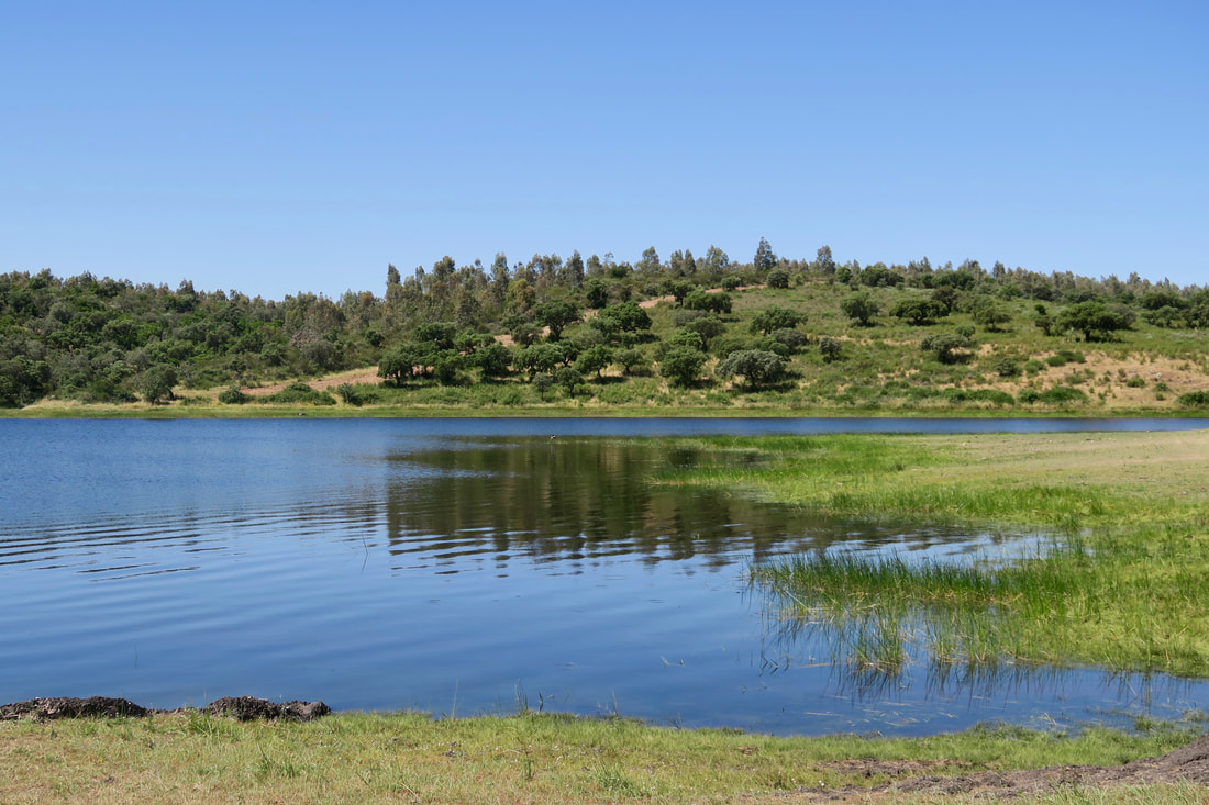
View across the charca from the path to the dam
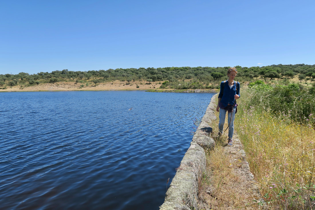
Walking on the dam
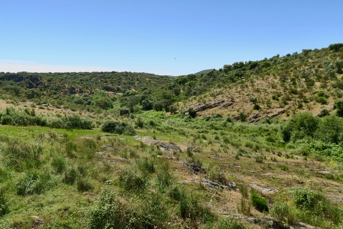
View of the valley from the dam
|
Charca Valderrey
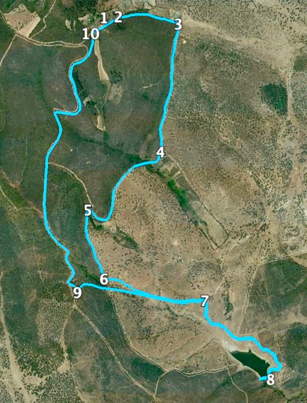
Information This route can be walked alone or added to the Walk of the Visigoth Church. The two walks together are 19.45 km. Do not walk in days of hot sun as there is little shade on the route. The terrain underfoot is poor, stony soil and scrubby. Nevertheless the vegetation; mainly cistus bushes, Spanish heath, rosemary, small evergreen oaks, cork oaks and juniper trees make the walk very satisfying as these all attract birds, bees and butterflies. Start: Parking area 500m beyond the Visigoth Church Finish: As above Time: 2.5 - 3 hours but allow time to explore the dam Distance: 10.20 kilometres Elevation: lowest 346m, highest 483m Difficulty: low for regular walkers Route: circular — map by Google Directions To walk the Charca Valderrey route only, arrive via the EX382 Alcuéscar to Montánchez road. Just before Alcuéscar, coming from Montánchez, there is a small yellow sign on the left side of the road directing traffic to the Santa Lucía del Trampal. That is the Visigoth Church. Follow the small road and the signs to the church. Park 500m after the church where the tarmaced road ends and there is a building and ample space for vehicles. 1. N39 08' 59.16" W06 13' 29.34" Walk back down the road and take the first turning on the right on to a track going downwards. 2. N39 09' 01.37 W06 13' 23.39" At the bottom of the track is a house and a few buildings on the left. Turn right at the fence ahead. (The tempting gate to the left is where the Walk of the Cork Oak trees, signposted in Alcuéscar, comes out to join the walk to the Charca Valderrey.) 3. N39 08' 58.76" W06 13' 03.58" Follow this track as it goes up and down through open areas of flowering bushes and sparse trees. Come to a Y junction but ignore the left track and keep on the main track. 4. N39 08' 25.85" W06 13' 12.82" Continue on the track. Pass a small house on the left as the track makes a right bend followed by a sharp left bend. Here the track becomes a footpath and passes through an area with a small stream and more lush vegetation. 5. N39 08' 12.24" W06 13' 38.72" The footpath becomes wider and the terrain may be ploughed up. Pass under a pylon. Views of the charca (reservoir) are ahead. 6. N39 07' 53.88" W06 13' 35.06" As the walk nears the charca there are many tracks and paths. Leave the main track to pick up footpaths and walk around the charca in a clockwise direction, crossing stream inlets by walking around them until they can be crossed. 7. N39 07 46.08" W06 13' 01.76" Explore the dam from the left side. 8. N39 07' 23.97" W06 12' 41.27" The dam is safe to walk along, or beside but there may be brambles and vegetation which can easily be pegged back with a stick. On the right is the water and on the left is a valley with an old house built on to the dam wall, a tower and various ruined buildings. These can be explored from the left of the dam, facing the valley. Retrace steps back to where a clear track on the left stretches ahead. It is lower than the track on the right and there is a gate. Pass through the gate and close it afterwards. 9. N39 07' 50.99" W06 13' 44.29" The track winds up and down through mainly cistus bushes and is very pretty when they are in flower in the Spring. Arrive at a wide track just to the left of the parking area. Turn right to reach the parking area. 10. N39 08' 57.26" W06 13' 33.06" Photos: May |