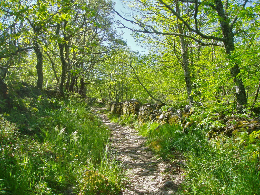
Path through the chestnut woods

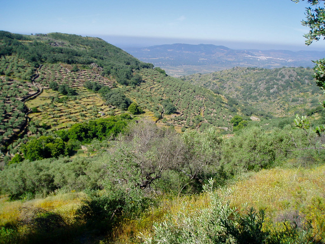
View between GPS3 and GPS4 overlooking the Arroyomolinos valley side
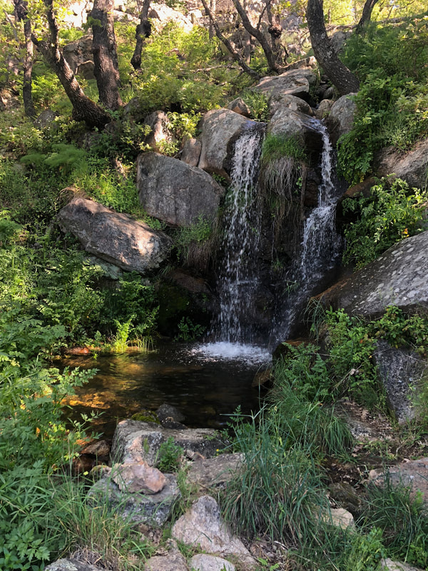
This cascade only falls after the winter rains
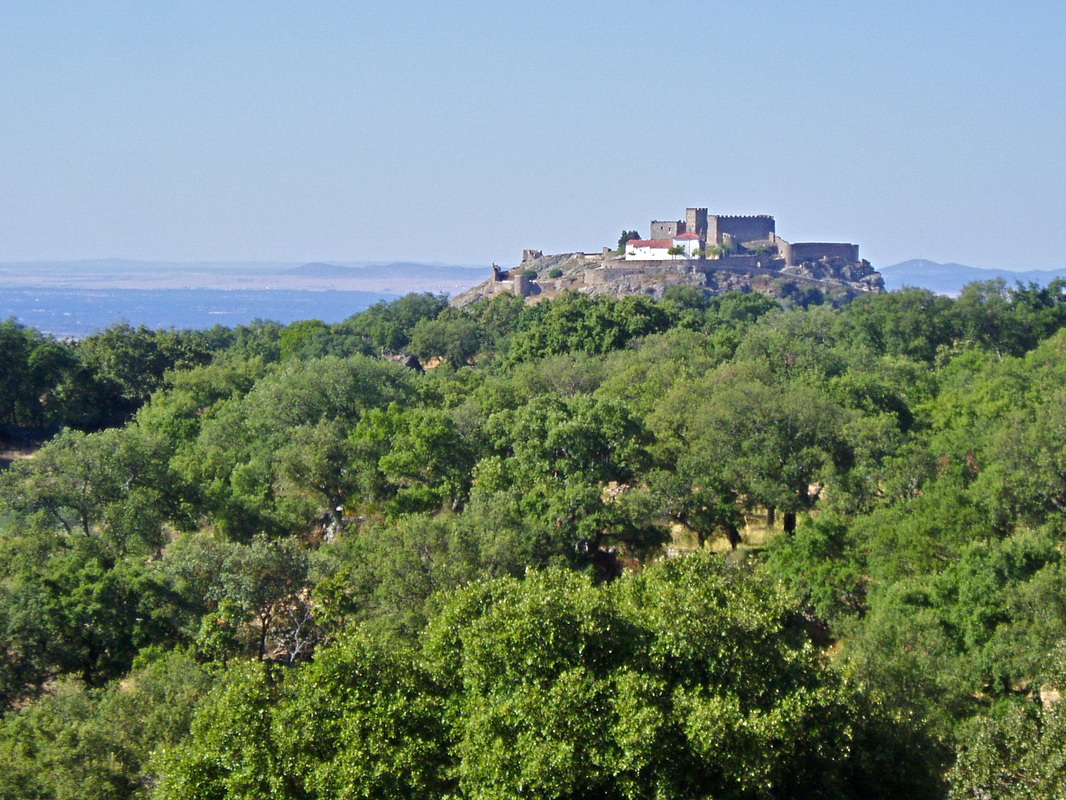
Montánchez castle seen from the chestnut woods near the end of the walk
|
La Ruta de Donde Nace
Information This route is one that the whole family can enjoy. It is very enjoyable on its own but can also form an extension to many other walks in the area. Part of the walk can be used to link longer walks with the town of Montánchez for café and bar breaks. The route follows an ancient granite-paved track around the top part of the mountain. The first half goes through extensive chestnut woods. These are very pretty in Spring, shady in Summer, colourful in Autumn and quiet in Winter. There are spectacular views towards Arroyomolinos, where the Walk of the Mill Valley starts. The second half of the route goes through agricultural land and passes the highest point of the sierra where the radio masts are located. The walk returns through another part of the chestnut woods with views of Montánchez castle. The route is sign-posted in blue at various points. Start: Montánchez Finish: Montánchez Time: 2.5 - 3 hours Distance: 8 kilometres, Mirador option, 8.50km Elevation: lowest 747m, highest 901m Difficulty: low for regular walkers Route: circular — map by Google Directions Park near the hotel, Fuente del Solar, at the top of the town by the route information board and begin the walk. 1. N 39º 13’ 15.0” W 06º 08’ 47.0” The route, painted blue, is the Ruta de Donde Nace. There is another walk that starts from here but it only goes as far as the chestnut wood. 2. N 39º 12’ 59.4” W 06º 08’ 43.9” Follow the directions on the blue signs. Pass farming land and many vineyards. One part of the path may be a bit boggy after rains. Enter the chestnut wood (photo 1). The mountain views can be seen through the trees. As the path comes out from the woods, the terrific view is on the right, towards the south-west. 3. N 39º 12’ 29.6” w 06º 08’ 33.8” Continue along the granite-paved path stopping to admire the view. Cross two places where, in rainy years, there is a small cascade of water and water flows down the side of the sierra and across the path. This water is part of the mill system as seen in the walk of the mill valley. 4. N 39º 12’ 15.2” W 06º 08’ 16.8” The views changes on going around the sierra (photo 2). The path ascends. After periods of rain this part of the path may run with water but there are granite stepping stones here and there. 5. N 39º 12’ 16.9” W 06º 07’ 41.7 Pass many flowering bushes, trees, stone walls and gently climb higher. Look back to see the lakes at the village of Casas de Don Antonio in the distance. After walking past the view on the right of the unsightly radio masts turn sharply left at the blue signpost. 6. N 39º 12’ 54.5” W 06º 07’ 50.4” Walk along a path with stone walls on one side. This is an area of farming; vineyards and meadows. The path turns into the granite-paved track again. It turns sharply right but as it is a single track there was no confusion about where to go. Follow the blue sign-posts. Continue the walk to enter the chestnut woods again. 7. N 39º 12’ 57.5” W 06º 08’ 21.9” At GPS 7 there is a sign pointing to the right, 'Mirador'. To see the view out over Montánchez, leave the path and go right for 125 metres. There is a viewing platform. a. N39° 13' 0.59" W06° 8' 18.47" Retrace steps back to the main path and continue the walk. Pass through the chestnut woods to come out into gentle farming land and a view of Montánchez castle perched on its rocky outcrop on the other side of the town (photo 3). 8. N 39º 13’ 02.0” W 06º 08’ 34.5” Or, at GPS 7, follow the Mirador path back to Montánchez. It is 2.00km long. Continuing the original walk is only a further 1.50km. Follow the path until it meets the minor road that goes from the radio masts to the right to the town to the left. b. N39° 13' 13.18" W06° 8' 13.02" Turn left and follow the minor road to a crossroads by a jamón factory. c. N39° 13' 20.09" W06° 8' 30.29" Turn left and follow the road back to a junction. d. N39° 13' 23.36" W06° 8' 49.21" Turn left to the car parking area. Complete the walk and stop to explore Montánchez. Stay long enough to enjoy a jamon bocadillo in the town’s attractive square. Photos: March, May and November 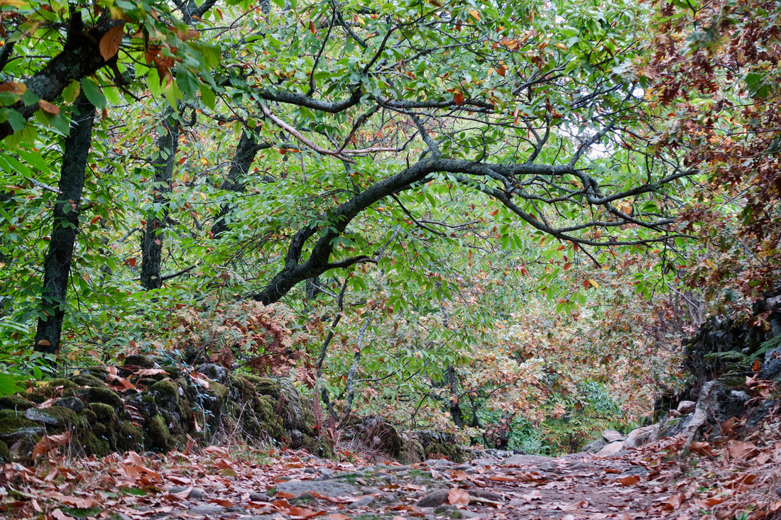
The chestnut woods in the Autumn are spectacular. Thousands of chestnut cases lie all around the woods with chestnuts inside. Many people walk here in November gathering bags full of chestnuts.
|